Air Ambulance Helicopter to Ashford, Kennington Road
Friday, 24 April 2026 | 23:36 | From Redhill Aerodrome
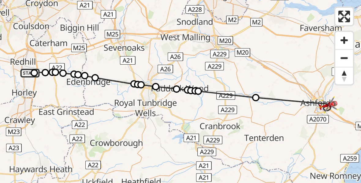
On Friday, 24 April 2026 at 23:36, a Air Ambulance Helicopter departed from Redhill Aerodrome to Ashford. It was the Air Ambulance Helicopter with registration number G-KSSC. The flight lasted 26 minutes. During that period, the aircraft travelled 50 miles at an average speed of 117 miles per hour at a maximum altitude of 1050 feet.
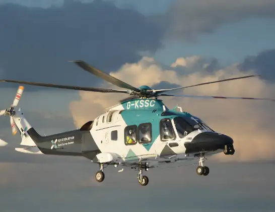
Helicopter: G-KSSC
The helicopter G-KSSC is used as a air ambulance helicopter. The main purpose of this aircraft is to transport a Mobile Medical Team to an incident as quickly as possible, enabling the trauma doctor to provide immediate first aid on site. The aircraft is flying this flight as Air Ambulance Helicopter.
Photo: Shona aakss
50 miles
1050 feet
117 mph
26 minutes
23:36
00:01

Route
Ashford, Kent00:01
Kennington Road, Kent00:01
Ashford, Kent23:52
Maidstone, Kent23:48
Paddock Wood, Kent23:48
Old Hay Airfield, Tonbridge, Kent23:48
Maidstone, Kent23:48
Paddock Wood, Kent23:47
Capel, Kent23:45
Tonbridge, Kent23:44
Sevenoaks, Kent23:44
Tonbridge, Kent23:44
Sevenoaks, Kent23:41
Edenbridge, Kent23:40
Tandridge, Surrey23:40
Oxted, Surrey23:40
Crowhurst, Surrey23:39
South Godstone, Surrey23:38
Blindley Heath, Surrey23:38
Tandridge, Surrey23:38
Coopers Hill Road, Surrey23:37
South Nutfield, Surrey23:37
Redhill Aerodrome, Redhill, Surrey23:36
Live flights
Today
Flights Ashford
Air Ambulance Helicopter to Redhill Aerodrome10 Jun 18:20
Air Ambulance Helicopter to Redhill Aerodrome30 May 11:18
Air Ambulance Helicopter to Rother, Ward's Lane28 May 21:12
Police Helicopter to Ashford27 May 12:21
Helicopter flights on your website?
You can easily display helicopter flights on your own website. Use the embed code.
