Coastguard Helicopter to Kirkbride Airfield
Friday, 24 April 2026 | 13:52 | From Carlisle Lake District Airport
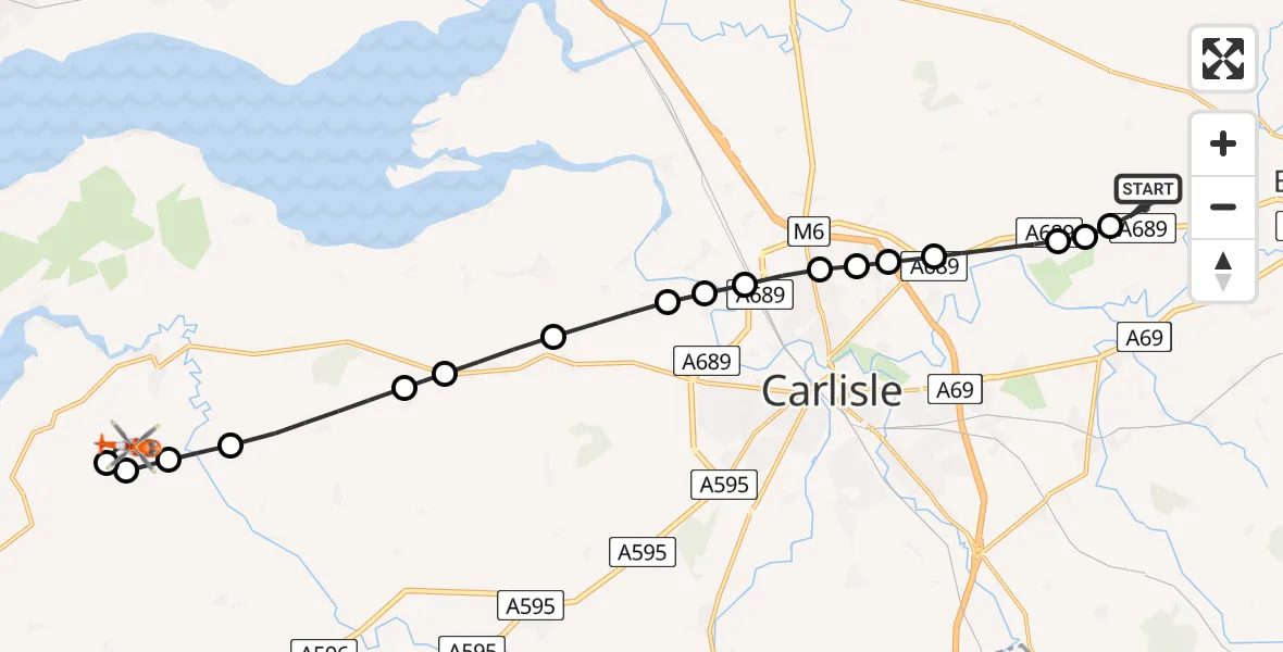
On Friday, 24 April 2026 at 13:52, a Coastguard Helicopter departed from Carlisle Lake District Airport to Kirkbride Airfield. It was the Coastguard Helicopter with registration number G-MCGO. The flight lasted 17 minutes. During that period, the aircraft travelled 20 miles at an average speed of 73 miles per hour at a maximum altitude of 1025 feet.
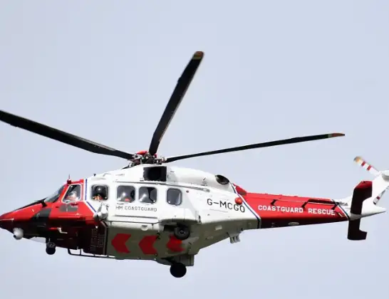
Helicopter: G-MCGO
The helicopter G-MCGO is used by the British Coastguard. The helicopter is deployed in search and rescue operations at sea, rescue operations involving ships or drilling platforms, patrols to prevent smuggling or piracy, environmental monitoring and disaster relief support.
Photo: Alec Wilson
21 miles
1025 feet
73 mph
17 minutes
13:52
14:08

Route
Kirkbride Airfield, Wigton, Cumbria14:08
Holme East Waver, Cumberland14:08
Kirkbride, Cumberland14:07
Kirkbride Airfield, Wigton, Cumbria14:07
Aikton, Cumberland14:07
Kirkbampton, Cumberland14:05
Thurstonfield, Cumberland14:05
Moorhouse, Cumberland14:04
Kirkandrews-on-Eden, Cumberland14:04
Grinsdale, Cumberland14:03
Cargo, Cumberland14:03
Carlisle, Cumberland14:03
Houghton, Cumberland14:02
Harker, Cumberland14:02
Houghton, Cumberland14:02
Low Crosby, Cumberland14:01
Brampton Road, Cumberland14:01
Irthington, Cumberland14:00
Carlisle Lake District Airport, Carlisle, Cumbria13:52
Live flights
Today
Helicopter flights on your website?
You can easily display helicopter flights on your own website. Use the embed code.
