Air Ambulance Helicopter to Aintree University Hospital Heliport
Thursday, 23 April 2026 | 22:21 | From Liverpool John Lennon Airport
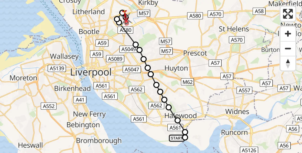
On Thursday, 23 April 2026 at 22:21, a Air Ambulance Helicopter departed from Liverpool John Lennon Airport to Aintree University Hospital Heliport. It was the Air Ambulance Helicopter with registration number G-NHAE. The flight lasted 12 minutes. During that period, the aircraft travelled 13 miles at an average speed of 63 miles per hour at a maximum altitude of 850 feet.
Helicopter: G-NHAE
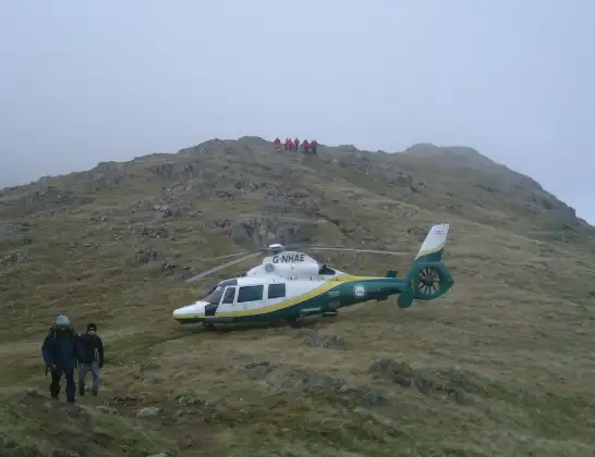
The helicopter G-NHAE is used as a air ambulance helicopter. The main purpose of this aircraft is to transport a Mobile Medical Team to an incident as quickly as possible, enabling the trauma doctor to provide immediate first aid on site. The aircraft is flying this flight as Air Ambulance Helicopter.
Photo: Michael Earnshaw
13 miles
850 feet
63 mph
13 minutes
22:21
22:34

Route
Aintree University Hospital Heliport, 22:34
Aintree University Hospital Heliport22:33
Fazakerley, Liverpool22:33
Orrell Park, Liverpool22:33
Fazakerley, Liverpool22:32
Norris Green, Liverpool22:32
West Derby, Liverpool22:31
Knotty Ash, Liverpool22:31
Knotty Ash, Knowsley22:31
Knotty Ash, Liverpool22:31
Belle Vale, Liverpool22:30
Gateacre, Liverpool22:30
Woolton, Liverpool22:30
Woolton, Knowsley22:30
Halewood, Knowsley22:29
Alder Wood Avenue, Merseyside - Liverpool22:29
Hale, Halton22:28
Liverpool John Lennon Airport, Liverpool22:22
Liverpool John Lennon Airport, Liverpool22:21
Live flights
Today
Helicopter flights on your website?
You can easily display helicopter flights on your own website. Use the embed code.
