Air Ambulance Helicopter to Metropolitan Police Air Support Unit Lippitts Hill
Thursday, 23 April 2026 | 14:44 | From Friern Barnet
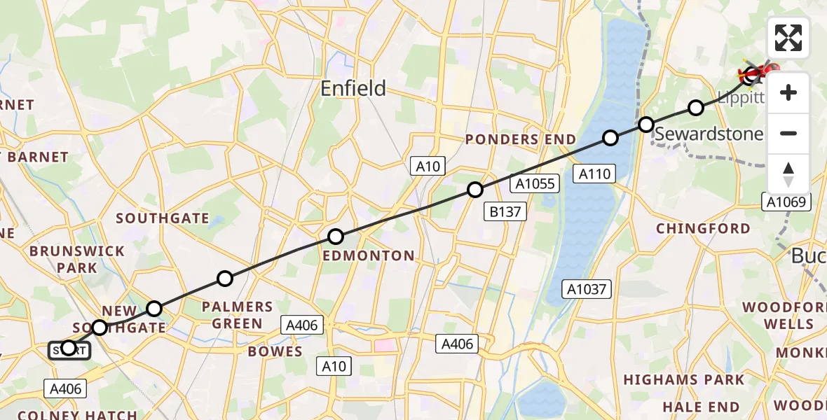
On Thursday, 23 April 2026 at 14:44, a Air Ambulance Helicopter departed from Friern Barnet to Metropolitan Police Air Support Unit Lippitts Hill. It was the Air Ambulance Helicopter with registration number G-LAAA. The flight lasted 7 minutes. During that period, the aircraft travelled 8 miles at an average speed of 64 miles per hour at a maximum altitude of 575 feet.
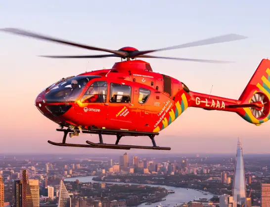
Helicopter: G-LAAA
The helicopter G-LAAA is used as a air ambulance helicopter. The main purpose of this aircraft is to transport a Mobile Medical Team to an incident as quickly as possible, enabling the trauma doctor to provide immediate first aid on site. The aircraft is flying this flight as Air Ambulance Helicopter.
Photo: Ton Snoei
8 miles
575 feet
64 mph
8 minutes
14:44
14:51

Route
Metropolitan Police Air Support Unit Lippitts Hill, Loughton, Essex14:51
Metropolitan Police Air Support Unit Lippitts Hill, Loughton, Essex14:51
Metropolitan Police Air Support Unit Lippitts Hill, Loughton, Essex14:50
Metropolitan Police Air Support Unit Lippitts Hill, Loughton, Essex14:50
Sewardstonebury, Essex14:50
Chingford, Essex14:49
Sewardstonebury, Essex14:48
King George V Reservoir14:48
Ponders End, Enfield14:47
Edmonton, Enfield14:46
Palmers Green, Enfield14:46
Southgate, Enfield14:45
Cranbrook Lane, Greater London - Enfield14:45
New Southgate, Enfield14:45
Colney Hatch, Barnet14:44
Friern Barnet, Greater London - Barnet14:44
Live flights
Air Ambulance Helicopter on its way from Roche22 Jul 23:12
Air Ambulance Helicopter on its way from Torquay22 Jul 22:54
Today
Air Ambulance Helicopter to Easton, New Ground22 Jul 22:48
Air Ambulance Helicopter to Southampton Airport22 Jul 22:45
Air Ambulance Helicopter to Norwich Airport22 Jul 22:32
Air Ambulance Aircraft to Glasgow Airport22 Jul 22:29
Air Ambulance Helicopter to Veryan, Elerkey Lane22 Jul 22:21
Air Ambulance Helicopter to Norwich Airport22 Jul 22:20
Air Ambulance Helicopter to Northrepps Aerodrome22 Jul 22:16
Air Ambulance Helicopter to Northrepps Aerodrome22 Jul 22:11
Police Helicopter to Manchester Barton Aerodrome22 Jul 22:06
Helicopter flights on your website?
You can easily display helicopter flights on your own website. Use the embed code.
