Air Ambulance Helicopter to Bualintur - Buaile an Todhair
Thursday, 23 April 2026 | 12:32 | From Coire Beithe
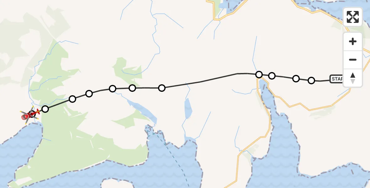
On Thursday, 23 April 2026 at 12:32, a Air Ambulance Helicopter departed from Coire Beithe to Bualintur - Buaile an Todhair. It was the Air Ambulance Helicopter with registration number G-GSAS. The flight lasted 6 minutes. During that period, the aircraft travelled 13 miles at an average speed of 132 miles per hour at a maximum altitude of 3350 feet.
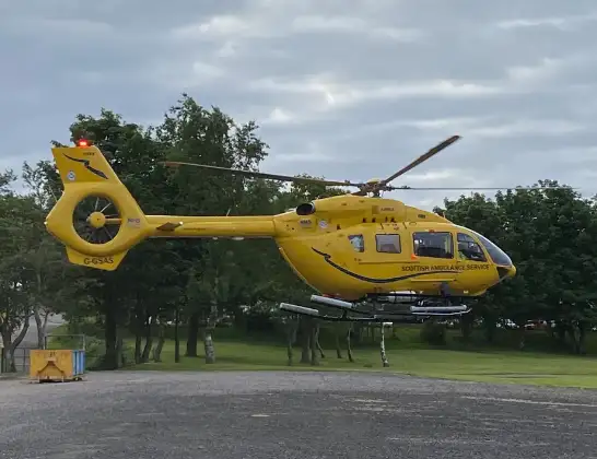
Helicopter: G-GSAS
The helicopter G-GSAS is used as a air ambulance helicopter. The main purpose of this aircraft is to transport a Mobile Medical Team to an incident as quickly as possible, enabling the trauma doctor to provide immediate first aid on site. The aircraft is flying this flight as Air Ambulance Helicopter.
Photo: Scanbus
14 miles
3350 feet
132 mph
7 minutes
12:32
12:38

Route
Bualintur - Buaile an Todhair, Highland12:38
Bualintur - Buaile an Todhair, Highland12:38
Highland, Highland12:37
Coire na Banachdaich, Highland12:37
Sròn Bhuidhe, Highland12:37
Coir'-uisg, Highland12:36
An Glas-choire, Highland12:36
Meallan Dearg, Highland12:35
Highland, Highland12:33
Torrin - Na Torrain, Highland12:33
Coire Sgreamhach, Highland12:33
Coire Odha, Highland12:32
Coire Beithe, Highland12:32
Live flights
Today
Helicopter flights on your website?
You can easily display helicopter flights on your own website. Use the embed code.
