Air Ambulance Helicopter to Poole, Pilsdon Drive
Thursday, 23 April 2026 | 11:36 | From Henstridge Airfield
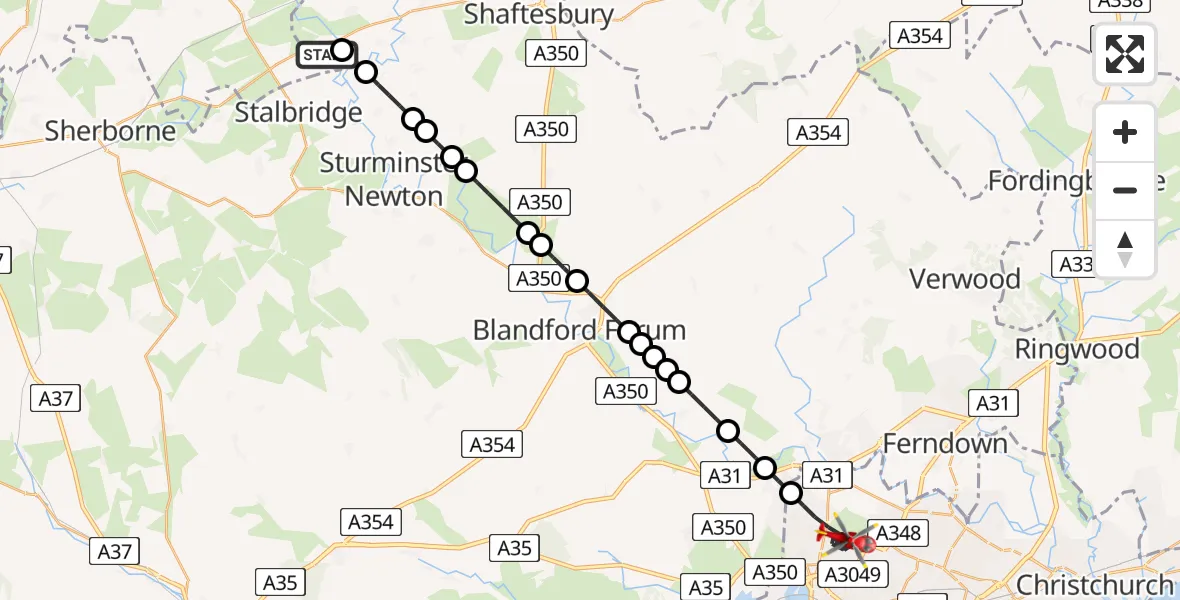
On Thursday, 23 April 2026 at 11:36, a Air Ambulance Helicopter departed from Henstridge Airfield to Poole. It was the Air Ambulance Helicopter with registration number G-DSAA. The flight lasted 17 minutes. During that period, the aircraft travelled 30 miles at an average speed of 105 miles per hour at a maximum altitude of 825 feet.
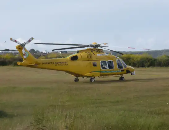
Helicopter: G-DSAA
The helicopter G-DSAA is used as a air ambulance helicopter. The main purpose of this aircraft is to transport a Mobile Medical Team to an incident as quickly as possible, enabling the trauma doctor to provide immediate first aid on site. The aircraft is flying this flight as Air Ambulance Helicopter.
Photo: Andrew Bone
31 miles
825 feet
105 mph
18 minutes
11:36
11:53

Route
Pilsdon Drive, Bournemouth, Christchurch and Poole11:53
Poole, Bournemouth, Christchurch and Poole11:46
Corfe Mullen, Dorset11:46
Pamphill, Dorset11:45
Shapwick, Dorset11:44
Tarrant Keyneston, Dorset11:44
Tarrant Rushton, Dorset11:44
Blandford Forum, Dorset11:43
Tarrant Rushton, Dorset11:43
Blandford Forum, Dorset11:42
Stourpaine, Dorset11:41
Shroton, Dorset11:41
Child Okeford, Dorset11:40
Manston, Dorset11:40
Todber, Dorset11:39
Sturminster Newton, Dorset11:39
Marnhull, Dorset11:38
Coking Lane, Dorset11:37
Fifehead Magdalen, Dorset11:37
Henstridge Airfield, Templecombe, Somerset11:36
Live flights
Today
Flights Poole
Coastguard Helicopter to Poole, Whitecliff Road28 Jun 12:47
Coastguard Helicopter to Poole, Whitecliff Road28 Jun 12:05
Coastguard Helicopter to Poole, Whitecliff Road28 Jun 11:46
Coastguard Helicopter to Poole, Whitecliff Road28 Jun 11:07
Coastguard Helicopter to Solent Airport30 May 21:16
Helicopter flights on your website?
You can easily display helicopter flights on your own website. Use the embed code.
