Police Helicopter to Metropolitan Police Air Support Unit Lippitts Hill
Thursday, 23 April 2026 | 11:24 | From Sewardstonebury
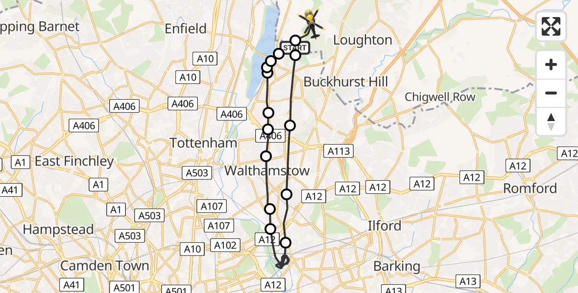
On Thursday, 23 April 2026 at 11:24, a Police Helicopter departed from Sewardstonebury to Metropolitan Police Air Support Unit Lippitts Hill. It was the Police Helicopter with registration number G-MPSA. The flight lasted 12 minutes. During that period, the aircraft travelled 19 miles at an average speed of 94 miles per hour at a maximum altitude of 975 feet.
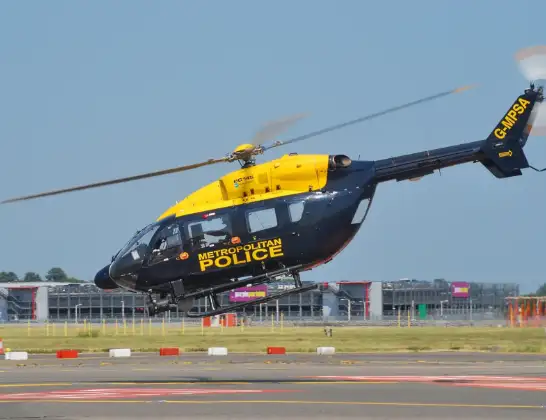
Helicopter: G-MPSA
The helicopter G-MPSA is used by the British police. The helicopter is deployed in pursuits, missing persons cases and other incidents where a helicopter provides added value.
Photo: Simon Boddy
19 miles
975 feet
94 mph
13 minutes
11:24
11:36

Route
Metropolitan Police Air Support Unit Lippitts Hill, Loughton, Essex11:36
Chingford, Essex11:36
Chingford, Waltham Forest11:35
Ponders End, Waltham Forest11:35
William Girling Reservoir11:35
Chingford, Waltham Forest11:35
Waltham Forest, Waltham Forest11:34
Highams Park, Waltham Forest11:34
Hale End, Waltham Forest11:33
Leyton, Waltham Forest11:32
Hackney Wick, Waltham Forest11:32
Stratford, Newham11:27
Leyton, Waltham Forest11:27
Highams Park, Waltham Forest11:26
Chingford, Waltham Forest11:24
Go Karts, Essex11:24
Today
Police Helicopter to Birmingham Airport10 Jun 23:20
Flights Sewardstonebury
Police Helicopter to Sewardstonebury, Bury Road10 Jun 21:58
Police Helicopter to Sewardstonebury, Blind Lane10 Jun 18:19
Police Helicopter to Sewardstonebury, Green Ride10 Jun 16:35
Police Helicopter to Kingsbury, Cool Oak Lane10 Jun 15:59
Helicopter flights on your website?
You can easily display helicopter flights on your own website. Use the embed code.
