Police Helicopter to Metropolitan Police Air Support Unit Lippitts Hill
Wednesday, 22 April 2026 | 20:43 | From Elstree Airfield
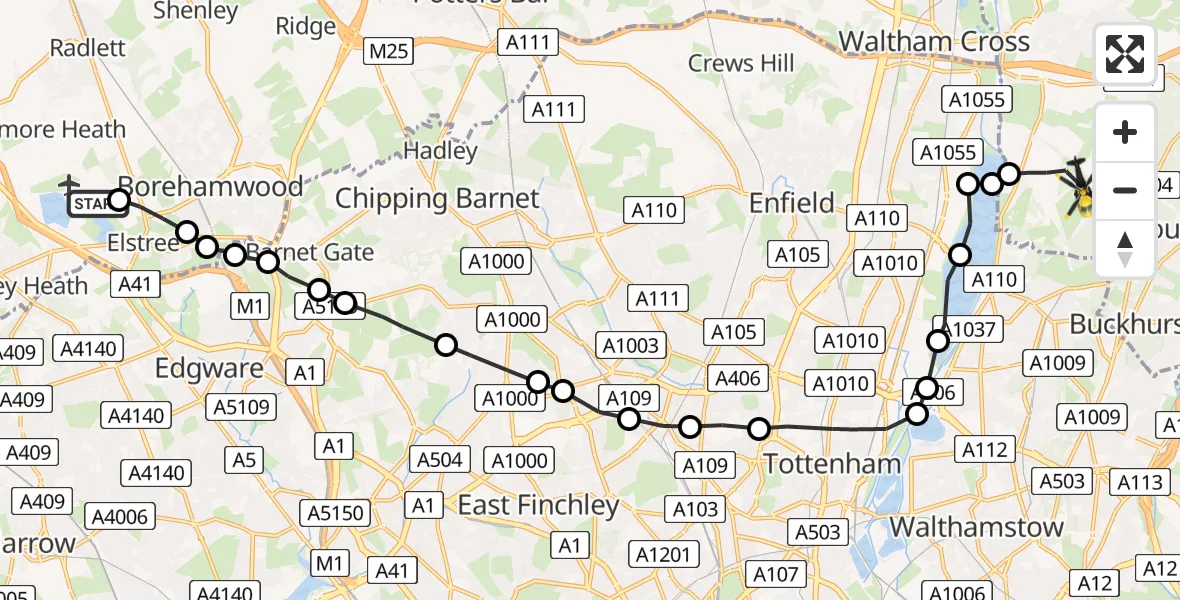
On Wednesday, 22 April 2026 at 20:43, a Police Helicopter departed from Elstree Airfield to Metropolitan Police Air Support Unit Lippitts Hill. It was the Police Helicopter with registration number G-MPSA. The flight lasted 10 minutes. During that period, the aircraft travelled 18 miles at an average speed of 103 miles per hour at a maximum altitude of 1075 feet.
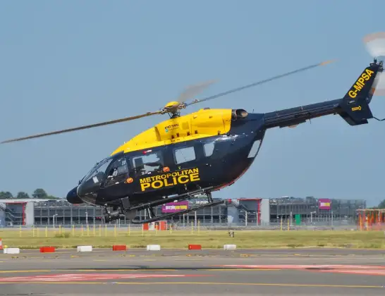
Helicopter: G-MPSA
The helicopter G-MPSA is used by the British police. The helicopter is deployed in pursuits, missing persons cases and other incidents where a helicopter provides added value.
Photo: Simon Boddy
18 miles
1075 feet
103 mph
11 minutes
20:43
20:53

Route
Metropolitan Police Air Support Unit Lippitts Hill, Loughton, Essex20:53
Sewardstonebury, Essex20:52
King George V Reservoir20:52
Enfield, Enfield20:52
King George V Reservoir20:51
William Girling Reservoir20:51
Waltham Forest, Waltham Forest20:50
Walthamstow, Waltham Forest20:50
Haringey, Haringey20:49
Hornsey, Haringey20:48
Muswell Hill, Haringey20:48
Colney Hatch, Barnet20:47
North Finchley, Barnet20:47
Woodside Park, Barnet20:46
Totteridge, Barnet20:45
Mill Hill, Barnet20:45
Mill Hill Golf Course, Barnet20:45
Hertfordshire, Hertfordshire20:44
Elstree, Hertfordshire20:44
Borehamwood, Hertfordshire20:44
Elstree, Hertfordshire20:43
Aldenham Road, Hertfordshire20:43
Live flights
Today
Helicopter flights on your website?
You can easily display helicopter flights on your own website. Use the embed code.
