Police Helicopter to Boverton, Northern Access Road
Wednesday, 22 April 2026 | 15:32 | From Llangynwyd Lower
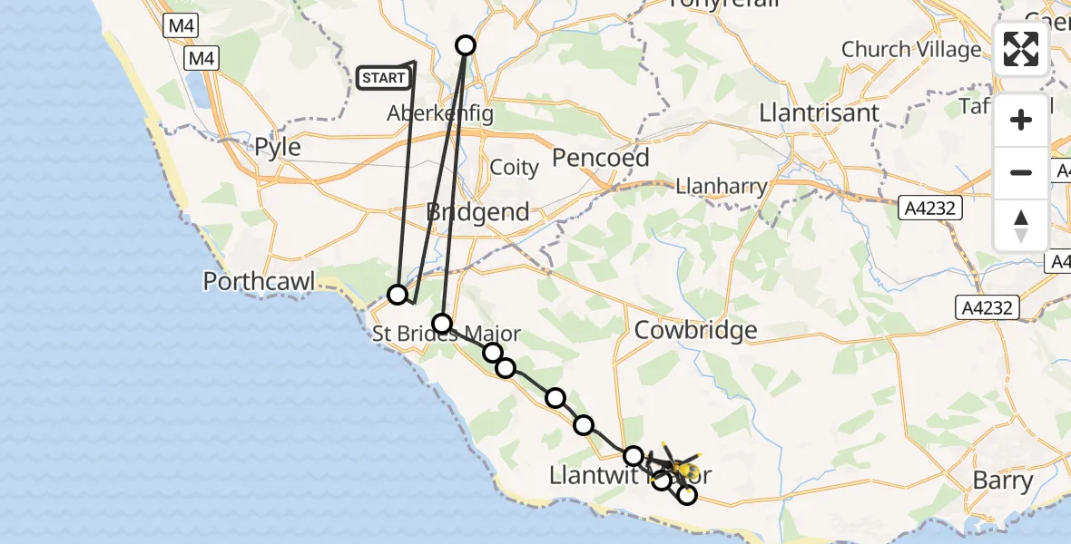
On Wednesday, 22 April 2026 at 15:32, a Police Helicopter departed from Llangynwyd Lower to Boverton. It was the Police Helicopter with registration number G-NWOI. The flight lasted 6 minutes. During that period, the aircraft travelled 30 miles at an average speed of 302 miles per hour at a maximum altitude of 975 feet.
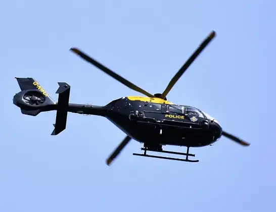
Helicopter: G-NWOI
The helicopter G-NWOI is used by the British police. The helicopter is deployed in pursuits, missing persons cases and other incidents where a helicopter provides added value.
Photo: Alec Wilson
30 miles
975 feet
302 mph
6 minutes
15:32
15:38

Route
Northern Access Road, Vale of Glamorgan15:38
MOD St Athan, St Athan, Vale of Glamorgan15:38
Boverton, Vale of Glamorgan15:37
Llanmaes, Vale of Glamorgan15:37
Llantwit Major, Vale of Glamorgan15:36
Marcross, Vale of Glamorgan15:36
Wick, Vale of Glamorgan15:35
St. Brides Major, Vale of Glamorgan15:35
St Brides Major, Vale of Glamorgan15:34
Bettws, Bridgend15:34
Ogmore, Vale of Glamorgan15:33
Ffordd-y-Gyfraith, Bridgend15:32
Live flights
Today
Flights Boverton
Police Helicopter to MOD St Athan21 Jul 21:05
Police Helicopter to MOD St Athan21 Jul 19:47
Police Helicopter to MOD St Athan20 Jul 20:33
Police Helicopter to MOD St Athan20 Jul 19:51
Police Helicopter to Pontypridd, Garth Avenue20 Jul 15:22
Police Helicopter to Bridgend, Min Y Coed18 Jul 15:09
Police Helicopter to Abertillery, Cwm17 Jul 16:33
Police Helicopter to Boverton, Monmouth Way16 Jul 01:43
Police Helicopter to Boverton, Llanmaes10 Jul 19:54
Police Helicopter to Bonvilston, Boverton Road10 Jul 01:05
Helicopter flights on your website?
You can easily display helicopter flights on your own website. Use the embed code.
