Coastguard Helicopter to Inner Seas
Wednesday, 22 April 2026 | 13:10 | From Coire Cadderlie
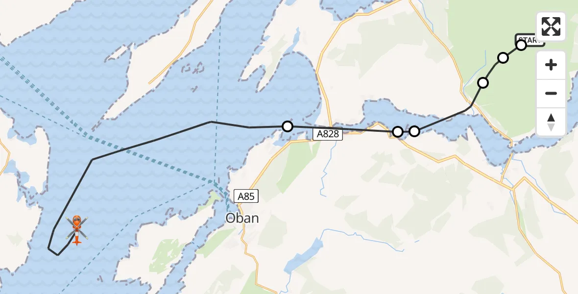
On Wednesday, 22 April 2026 at 13:10, a Coastguard Helicopter departed from Coire Cadderlie to Inner Seas. It was the Coastguard Helicopter with registration number G-MCGT. The flight lasted 12 minutes. During that period, the aircraft travelled 22 miles at an average speed of 105 miles per hour at a maximum altitude of 1825 feet.

Helicopter: G-MCGT
The helicopter G-MCGT is used by the British Coastguard. The helicopter is deployed in search and rescue operations at sea, rescue operations involving ships or drilling platforms, patrols to prevent smuggling or piracy, environmental monitoring and disaster relief support.
Photo: Ronnie Macdonald
22 miles
1825 feet
105 mph
13 minutes
13:10
13:22

Route
Inner Seas, 13:22
Inner Seas, 13:16
Inner Seas13:14
Connel, Argyll and Bute13:13
Oban, Argyll and Bute13:12
Inveresragan, Argyll and Bute13:11
Argyll and Bute, Argyll and Bute13:10
Coire Seilich, Argyll and Bute13:10
Coire Cadderlie, Argyll and Bute13:10
Live flights
Police Helicopter on its way from Coopersale21 Jul 22:51
Today
Air Ambulance Helicopter to Norwich Airport21 Jul 22:28
Police Helicopter to Benson, Brook Street21 Jul 22:12
Police Helicopter to Birmingham Airport21 Jul 22:04
Air Ambulance Helicopter to Ilfracombe, A36121 Jul 22:03
Coastguard Helicopter to Achmacraobh21 Jul 21:27
Helicopter flights on your website?
You can easily display helicopter flights on your own website. Use the embed code.
