Police Helicopter to Keltie Bridge, Drumloist Road
Tuesday, 21 April 2026 | 15:27 | From Stirling
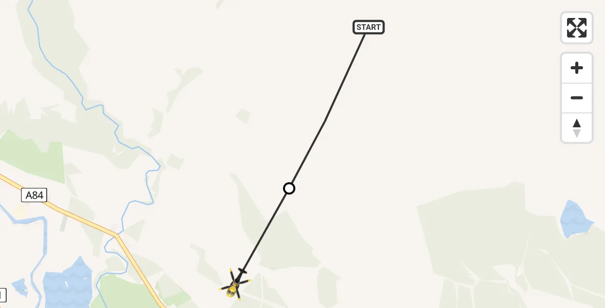
On Tuesday, 21 April 2026 at 15:27, a Police Helicopter departed from Stirling to Keltie Bridge. It was the Police Helicopter with registration number G-POLS. The flight lasted 1 minutes. During that period, the aircraft travelled 2 miles at an average speed of 140 miles per hour at a maximum altitude of 2400 feet.
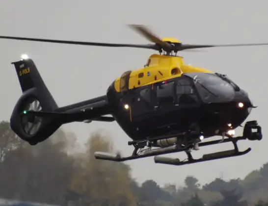
Helicopter: G-POLS
The helicopter G-POLS is used by the British police. The helicopter is deployed in pursuits, missing persons cases and other incidents where a helicopter provides added value.
Photo: James from Cheltenham, Gloucestershire
3 miles
2400 feet
140 mph
1 minutes
15:27
15:28

Route
Drumloist Road, Stirling15:28
Keltie Bridge, Stirling15:27
Stirling, Stirling15:27
Live flights
Today
Flights Stirling
Coastguard Helicopter to Coire a`Bhachaill18 Jul 14:15
Police Helicopter to Linwood, B81814 Jul 13:04
Air Ambulance Helicopter to Inner Seas12 Jul 20:45
Police Helicopter to Stirling, New Line Road12 Jul 14:32
Coastguard Helicopter to Killin, Stirling22 Jun 14:48
Coastguard Helicopter to Killin, Stirling22 Jun 14:24
Coastguard Helicopter to Stirling, A8421 Jun 16:32
Helicopter flights on your website?
You can easily display helicopter flights on your own website. Use the embed code.
