Police Helicopter to Redhill Aerodrome
Tuesday, 21 April 2026 | 13:38 | From South Nutfield
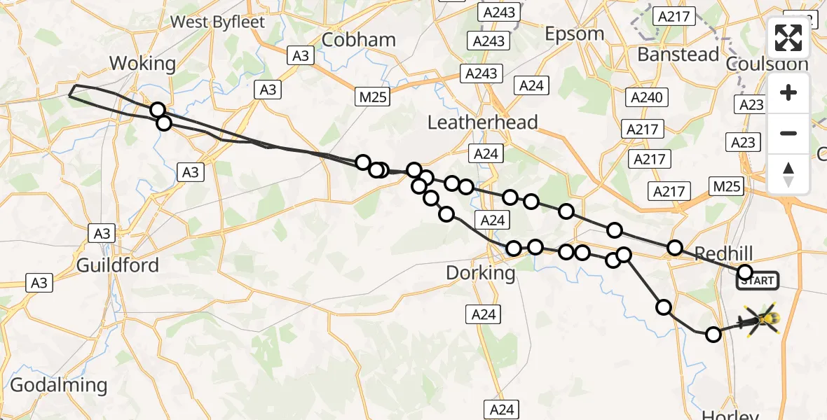
On Tuesday, 21 April 2026 at 13:38, a Police Helicopter departed from South Nutfield to Redhill Aerodrome. It was the Police Helicopter with registration number G-POLH. The flight lasted 19 minutes. During that period, the aircraft travelled 43 miles at an average speed of 135 miles per hour at a maximum altitude of 900 feet.
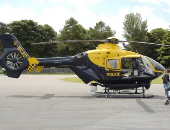
Helicopter: G-POLH
The helicopter G-POLH is used by the British police. The helicopter is deployed in pursuits, missing persons cases and other incidents where a helicopter provides added value.
Photo: Arpingstone
44 miles
900 feet
135 mph
20 minutes
13:38
13:57

Route
Redhill Aerodrome, Redhill, Surrey13:57
Salfords, Surrey13:56
Reigate, Surrey13:55
Buckland, Surrey13:55
Reigate, Surrey13:54
Buckland, Surrey13:54
Betchworth, Surrey13:54
Brockham, Surrey13:53
Pixham, Surrey13:53
Westhumble, Surrey13:52
Great Bookham, Surrey13:52
Goldstone Farm Airstrip13:51
Great Bookham, Surrey13:51
Effingham, Surrey13:51
Guildford, Surrey13:47
Woking, Surrey13:45
Guildford, Surrey13:42
Effingham, Surrey13:42
Great Bookham, Surrey13:42
Hawk's Hill, Surrey13:41
Westhumble, Surrey13:41
Mickleham, Surrey13:41
Headley, Surrey13:41
Box Hill Village, Surrey13:40
Buckland, Surrey13:40
Reigate, Surrey13:39
Redhill, Surrey13:38
Hogtrough Lane, Surrey13:38
Live flights
Today
Helicopter flights on your website?
You can easily display helicopter flights on your own website. Use the embed code.
