Air Ambulance Helicopter to Brighton, Eastern Road
Tuesday, 21 April 2026 | 13:34 | From Brighton City Airport
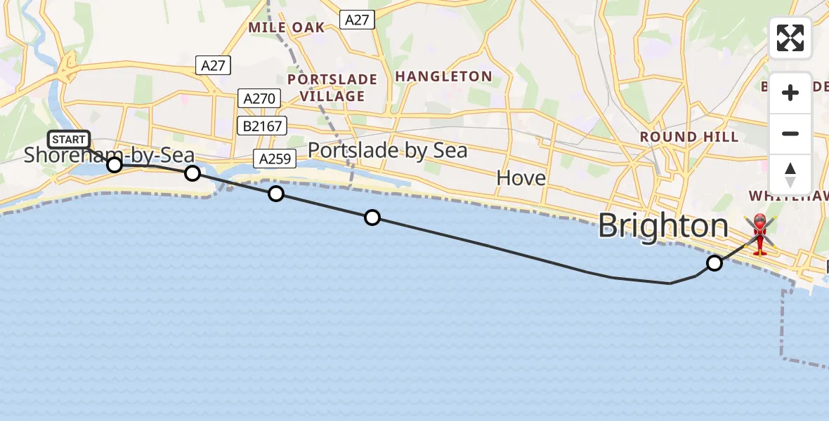
On Tuesday, 21 April 2026 at 13:34, a Air Ambulance Helicopter departed from Brighton City Airport to Brighton. It was the Air Ambulance Helicopter with registration number G-KSSC. The flight lasted 7 minutes. During that period, the aircraft travelled 8 miles at an average speed of 68 miles per hour at a maximum altitude of 725 feet.
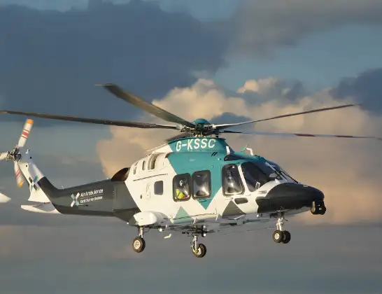
Helicopter: G-KSSC
The helicopter G-KSSC is used as a air ambulance helicopter. The main purpose of this aircraft is to transport a Mobile Medical Team to an incident as quickly as possible, enabling the trauma doctor to provide immediate first aid on site. The aircraft is flying this flight as Air Ambulance Helicopter.
Photo: Shona aakss
8 miles
725 feet
68 mph
7 minutes
13:34
13:41

Route
Brighton, Brighton and Hove13:41
Eastern Road, Brighton and Hove13:40
Eastern Road, Brighton and Hove13:39
Brighton, Brighton and Hove13:38
English Channel13:36
Southwick, West Sussex13:35
Kingston Buci, West Sussex13:35
Anchor Close, West Sussex13:34
Shoreham-by-Sea, West Sussex13:34
Brighton City Airport, Brighton, East Sussex13:34
Live flights
Today
Flights Brighton
Helicopter flights on your website?
You can easily display helicopter flights on your own website. Use the embed code.
