Air Ambulance Helicopter to Caroy - An Cadha Ruadh
Sunday, 19 April 2026 | 13:20 | From Inner Seas
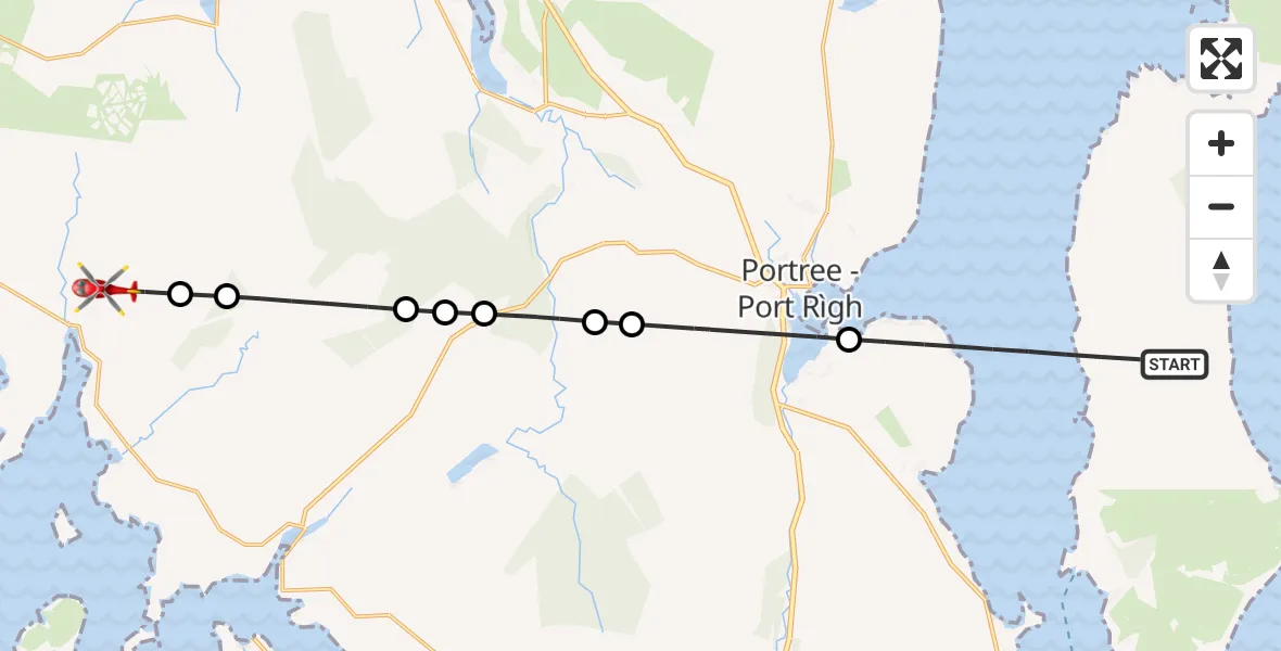
On Sunday, 19 April 2026 at 13:20, a Air Ambulance Helicopter departed from Inner Seas to Caroy - An Cadha Ruadh. It was the Air Ambulance Helicopter with registration number G-GSAS. The flight lasted 7 minutes. During that period, the aircraft travelled 16 miles at an average speed of 135 miles per hour at a maximum altitude of 1700 feet.
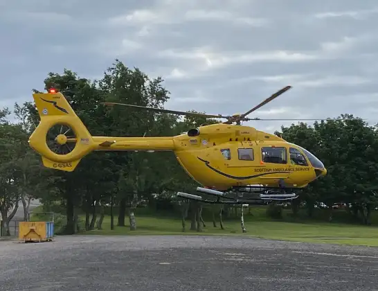
Helicopter: G-GSAS
The helicopter G-GSAS is used as a air ambulance helicopter. The main purpose of this aircraft is to transport a Mobile Medical Team to an incident as quickly as possible, enabling the trauma doctor to provide immediate first aid on site. The aircraft is flying this flight as Air Ambulance Helicopter.
Photo: Scanbus
17 miles
1700 feet
135 mph
8 minutes
13:20
13:28

Route
Caroy - An Cadha Ruadh, Highland13:28
Balmeanach - Baile Meadhanach, Highland13:27
Highland, Highland13:27
Glen Vic Askill, Highland13:26
Highland, Highland13:25
Struan - An Sruthan, Highland13:25
Highland, Highland13:24
Glenmore - An Gleann Mòr, Highland13:24
Portree - Port Rìgh, Highland13:23
Inner Seas, 13:20
Live flights
Today
Police Helicopter to Crickadarn01:28:18
Helicopter flights on your website?
You can easily display helicopter flights on your own website. Use the embed code.
