Air Ambulance Helicopter to Pitsmoor, Herries Road
Sunday, 19 April 2026 | 11:54 | From Calver CP
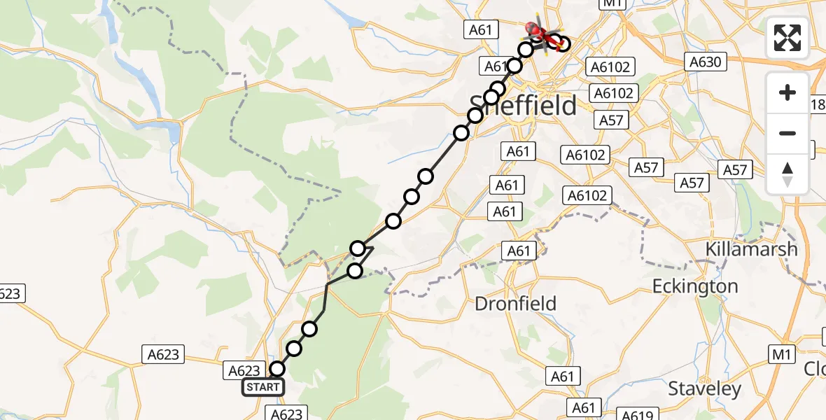
On Sunday, 19 April 2026 at 11:54, a Air Ambulance Helicopter departed from Calver CP to Pitsmoor. It was the Air Ambulance Helicopter with registration number G-DRLA. The flight lasted 6 minutes. During that period, the aircraft travelled 18 miles at an average speed of 186 miles per hour at a maximum altitude of 1375 feet.
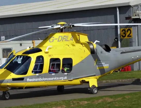
Helicopter: G-DRLA
The helicopter G-DRLA is used as an ambulance helicopter. The helicopter is equipped with a stretcher for transporting patients. The helicopter is often used to transport to hospitals.
Photo: Alec Wilson
19 miles
1375 feet
186 mph
6 minutes
11:54
12:00

Route
Herries Road, South Yorkshire - Sheffield12:00
Pitsmoor, Sheffield11:59
Neepsend, Sheffield11:59
Page Hall, Sheffield11:59
Pitsmoor, Sheffield11:58
Netherthorpe, Sheffield11:58
Neepsend, Sheffield11:58
Netherthorpe, Sheffield11:58
Broomhill, Sheffield11:57
Greystones, Sheffield11:57
Bents Green, Sheffield11:57
Whirlow, Sheffield11:56
Dore, Sheffield11:56
Piper House ruins, Sheffield11:56
Sheffield, Sheffield11:55
Grindleford, Derbyshire11:55
Derbyshire Dales, Derbyshire11:54
Curbar CP, Derbyshire11:54
Sough Lane, Derbyshire11:54
Live flights
Today
Flights Pitsmoor
Helicopter flights on your website?
You can easily display helicopter flights on your own website. Use the embed code.
