Air Ambulance Helicopter to Hatfield and Newhampton, Worcester Road
Sunday, 19 April 2026 | 9:56 | From Hill Croome
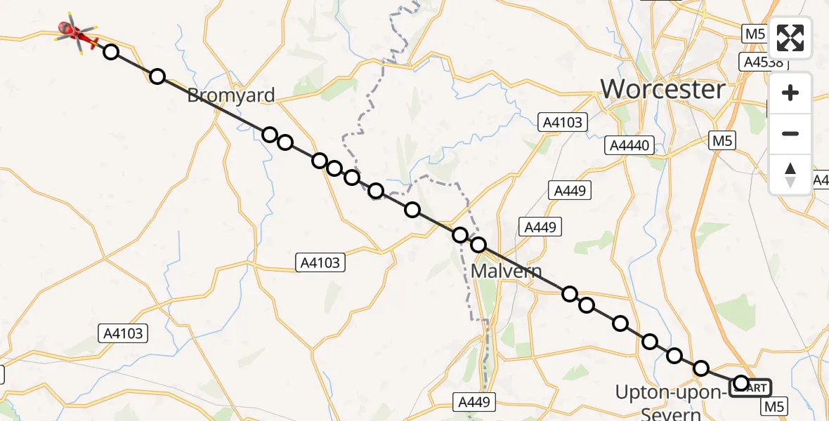
On Sunday, 19 April 2026 at 9:56, a Air Ambulance Helicopter departed from Hill Croome to Hatfield and Newhampton. It was the Air Ambulance Helicopter with registration number G-OMAA. The flight lasted 10 minutes. During that period, the aircraft travelled 22 miles at an average speed of 133 miles per hour at a maximum altitude of 1325 feet.
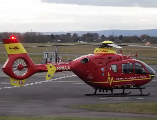
Helicopter: G-OMAA
The helicopter G-OMAA is used as a air ambulance helicopter. The main purpose of this aircraft is to transport a Mobile Medical Team to an incident as quickly as possible, enabling the trauma doctor to provide immediate first aid on site. The aircraft is flying this flight as Air Ambulance Helicopter.
Photo: James from Cheltenham, Gloucestershire
22 miles
1325 feet
133 mph
10 minutes
09:56
10:05

Route
Worcester Road, West Midlands - Herefordshire10:05
Grendon Bishop, Herefordshire10:05
Bredenbury, Herefordshire10:04
Bromyard, Herefordshire10:03
Stanford Bishop, Herefordshire10:03
Stony Cross, Herefordshire10:02
Stanford Bishop, Herefordshire10:02
Longley Green, Herefordshire10:02
Malvern Hills, Herefordshire10:01
Cradley, Herefordshire10:01
Storridge, Herefordshire10:00
Malvern Hills, Worcestershire10:00
Malvern, Worcestershire09:59
Guarlford, Worcestershire09:58
Hanley Castle, Worcestershire09:58
Upton-upon-Severn, Worcestershire09:57
Ripple, Worcestershire09:57
Quay Lane, West Midlands - Worcestershire09:57
Hill Croome, West Midlands - Worcestershire09:56
M5, West Midlands - Worcestershire09:56
Live flights
Today
Police Helicopter to Irlam, M6203:28:05
Police Helicopter to Solihull, A4520 Jul 23:50
Helicopter flights on your website?
You can easily display helicopter flights on your own website. Use the embed code.
