Air Ambulance Helicopter to Nottingham Heliport
Sunday, 19 April 2026 | 9:17 | From Holbrook CP
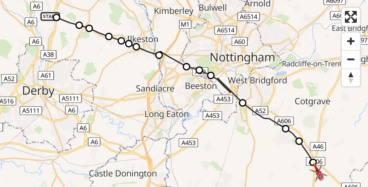
On Sunday, 19 April 2026 at 9:17, a Air Ambulance Helicopter departed from Holbrook CP to Nottingham Heliport. It was the Air Ambulance Helicopter with registration number G-DRLA. The flight lasted 8 minutes. During that period, the aircraft travelled 24 miles at an average speed of 186 miles per hour at a maximum altitude of 825 feet.
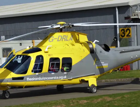
Helicopter: G-DRLA
The helicopter G-DRLA is used as an ambulance helicopter. The helicopter is equipped with a stretcher for transporting patients. The helicopter is often used to transport to hospitals.
Photo: Alec Wilson
25 miles
825 feet
186 mph
8 minutes
09:17
09:24

Route
Nottingham Heliport, 09:24
Widmerpool, Nottinghamshire09:24
Stanton on the Wolds, Nottinghamshire09:23
Normanton on the Wolds, Nottinghamshire09:23
Ruddington, Nottinghamshire09:22
City of Nottingham, Nottingham09:21
Wollaton, Nottingham09:20
Bramcote, Nottinghamshire09:20
Trowell, Nottinghamshire09:19
Ilkeston, Derbyshire09:19
Dale Abbey, Derbyshire09:19
Kirk Hallam, Derbyshire09:19
West Hallam, Derbyshire09:18
Stanley Common, Derbyshire09:18
Smalley CP, Derbyshire09:18
Horsley, Derbyshire09:17
Portway, Derbyshire09:17
Live flights
Today
Police Helicopter to Irlam, M6203:28:05
Police Helicopter to Solihull, A4520 Jul 23:50
Helicopter flights on your website?
You can easily display helicopter flights on your own website. Use the embed code.
