Police Helicopter to South Nutfield, M23
Saturday, 18 April 2026 | 16:55 | From Tandridge
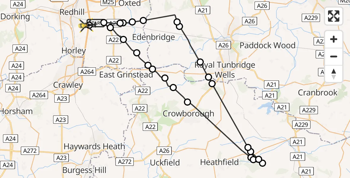
On Saturday, 18 April 2026 at 16:55, a Police Helicopter departed from Tandridge to South Nutfield. It was the Police Helicopter with registration number G-POLH. The flight lasted 27 minutes. During that period, the aircraft travelled 60 miles at an average speed of 135 miles per hour at a maximum altitude of 900 feet.
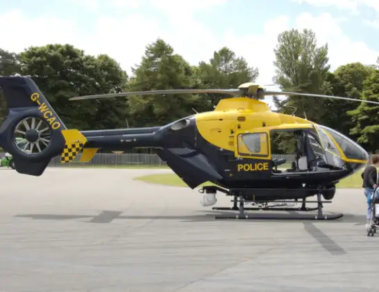
Helicopter: G-POLH
The helicopter G-POLH is used by the British police. The helicopter is deployed in pursuits, missing persons cases and other incidents where a helicopter provides added value.
Photo: Arpingstone
61 miles
900 feet
135 mph
27 minutes
16:55
17:22

Route
M23, Surrey17:22
South Nutfield, Surrey17:22
Tandridge, Surrey17:20
South Godstone, Surrey17:19
Crowhurst, Surrey17:19
Oxted, Surrey17:19
Tandridge, Surrey17:18
Sevenoaks, Kent17:16
Bough Beech Reservoir17:16
Sevenoaks, Kent17:14
Speldhurst, Kent17:13
Wealden, East Sussex17:12
Rother, East Sussex17:07
Burwash Common, East Sussex17:07
Burwash Weald, East Sussex17:06
Brightling, East Sussex17:06
Burwash Weald, East Sussex17:05
Burwash Common, East Sussex17:05
Wealden, East Sussex17:01
Withyham, East Sussex17:00
Hartfield, East Sussex17:00
Wealden, East Sussex16:59
Tandridge, Surrey16:58
Dormansland, Surrey16:58
Lingfield, Surrey16:57
Blindley Heath, Surrey16:56
Outwood Lane, Surrey16:55
Today
Flights Tandridge
Police Helicopter to Salfords, Cross Oak Lane31 May 19:55
Helicopter flights on your website?
You can easily display helicopter flights on your own website. Use the embed code.
