Police Helicopter to Brandy Carr, Stoney Lane
Friday, 17 April 2026 | 22:48 | From East Ardsley
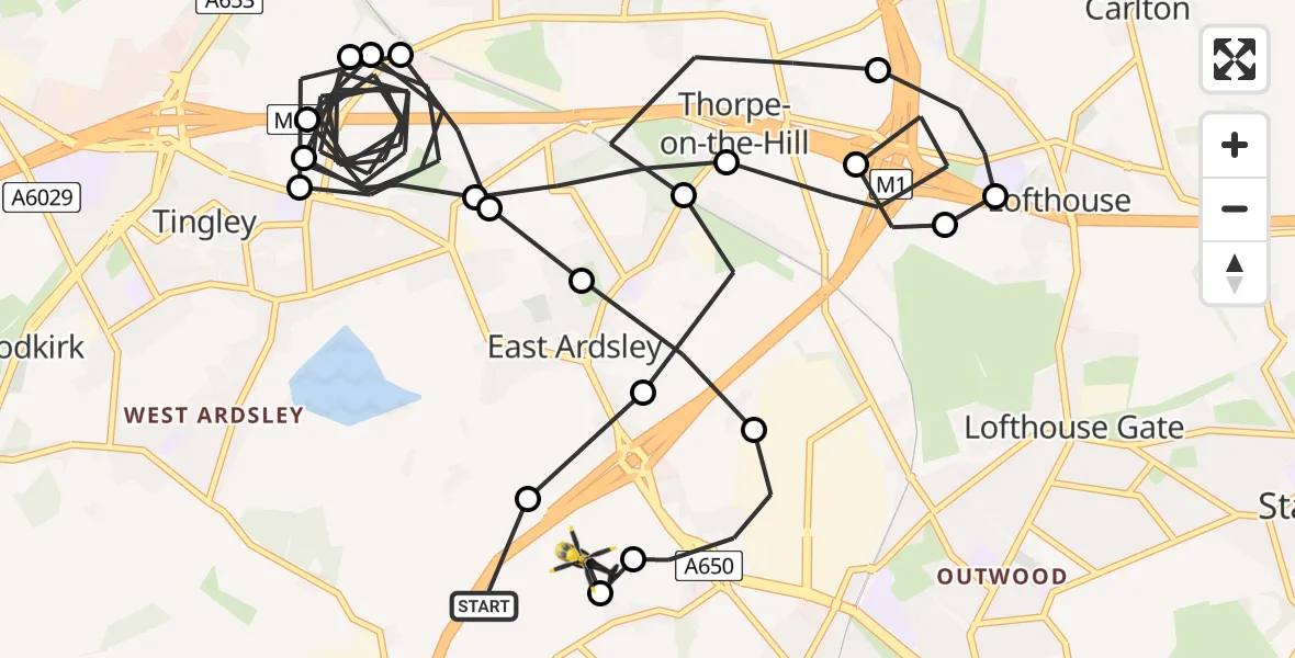
On Friday, 17 April 2026 at 22:48, a Police Helicopter departed from East Ardsley to Brandy Carr. It was the Police Helicopter with registration number G-POLB. The flight lasted 18 minutes. During that period, the aircraft travelled 19 miles at an average speed of 66 miles per hour at a maximum altitude of 1400 feet.
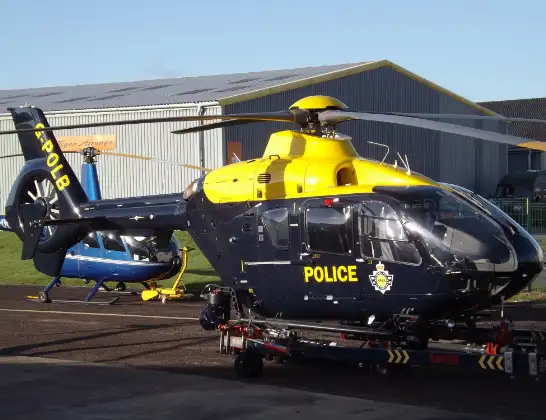
Helicopter: G-POLB
The helicopter G-POLB is used by the British police. The helicopter is deployed in pursuits, missing persons cases and other incidents where a helicopter provides added value.
Photo: James from Cheltenham, Gloucestershire
20 miles
1400 feet
66 mph
18 minutes
22:48
23:05

Route
Stoney Lane, West Yorkshire - Wakefield23:05
East Ardsley, Wakefield23:05
Brandy Carr, Wakefield23:05
Lofthouse Gate, Wakefield23:04
East Ardsley, Leeds23:04
Thorpe-on-the-Hill, Leeds23:03
East Ardsley, Leeds23:03
Tingley, Leeds23:02
East Ardsley, Leeds23:01
Tingley, Leeds23:01
East Ardsley, Leeds23:00
Tingley, Leeds23:00
East Ardsley, Leeds22:53
Thorpe-on-the-Hill, Leeds22:53
Robin Hood, Leeds22:51
Lofthouse Gate, Wakefield22:51
Lofthouse, Leeds22:51
Robin Hood, Leeds22:50
Thorpe-on-the-Hill, Leeds22:49
East Ardsley, Leeds22:48
Brandy Carr, Leeds22:48
M1, West Yorkshire - Leeds22:48
Live flights
Today
Helicopter flights on your website?
You can easily display helicopter flights on your own website. Use the embed code.
