Police Helicopter to Crowmarsh Gifford, Cox's Lane
Friday, 17 April 2026 | 0:01 | From Crowmarsh Gifford
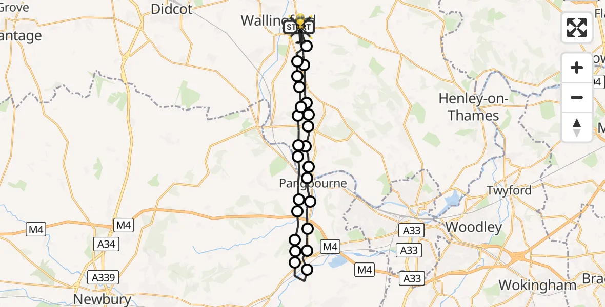
On Friday, 17 April 2026 at 0:01, a Police Helicopter departed from Crowmarsh Gifford to Crowmarsh Gifford. It was the Police Helicopter with registration number G-POLF. The flight lasted 11 minutes. During that period, the aircraft travelled 26 miles at an average speed of 139 miles per hour at a maximum altitude of 1400 feet.
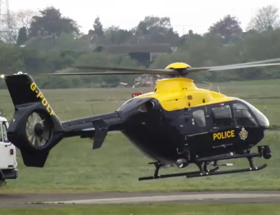
Helicopter: G-POLF
The helicopter G-POLF is used by the British police. The helicopter is deployed in pursuits, missing persons cases and other incidents where a helicopter provides added value.
Photo: James
26 miles
1400 feet
139 mph
12 minutes
00:01
00:12

Route
Cox's Lane, Oxfordshire00:12
Crowmarsh Gifford, Oxfordshire00:11
North Stoke, Oxfordshire00:11
Ipsden, Oxfordshire00:11
Chiltern Park Aerodrome, Reading, Oxfordshire00:11
Woodcote, Oxfordshire00:10
South Oxfordshire, Oxfordshire00:10
Goring-on-Thames, Oxfordshire00:10
Whitchurch-on-Thames, Oxfordshire00:09
Pangbourne, West Berkshire00:09
Tidmarsh, West Berkshire00:08
Englefield, West Berkshire00:08
Theale, West Berkshire00:08
Englefield Airstrip, Reading, Berkshire00:07
Sulhamstead, West Berkshire00:07
Theale, West Berkshire00:06
Englefield, West Berkshire00:06
Tidmarsh, West Berkshire00:05
Pangbourne, West Berkshire00:04
Whitchurch-on-Thames, Oxfordshire00:04
Whitchurch Hill, Oxfordshire00:04
Woodcote, Oxfordshire00:03
South Oxfordshire, Oxfordshire00:03
Woodcote, Oxfordshire00:03
Ipsden, Oxfordshire00:02
Park View, Oxfordshire00:01
Live flights
Today
Helicopter flights on your website?
You can easily display helicopter flights on your own website. Use the embed code.
