Air Ambulance Helicopter to Maidstone, Penenden Heath Road
Thursday, 16 April 2026 | 19:37 | From Redhill Aerodrome
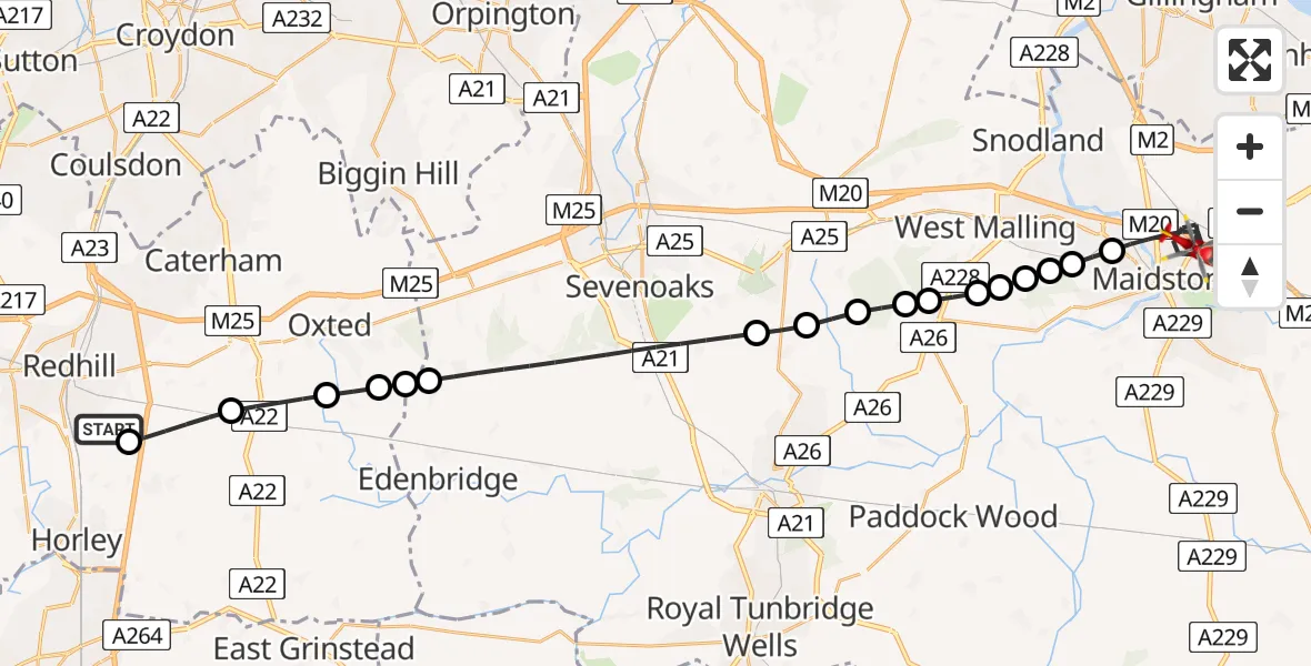
On Thursday, 16 April 2026 at 19:37, a Air Ambulance Helicopter departed from Redhill Aerodrome to Maidstone. It was the Air Ambulance Helicopter with registration number G-LNAC. The flight lasted 17 minutes. During that period, the aircraft travelled 34 miles at an average speed of 119 miles per hour at a maximum altitude of 1175 feet.
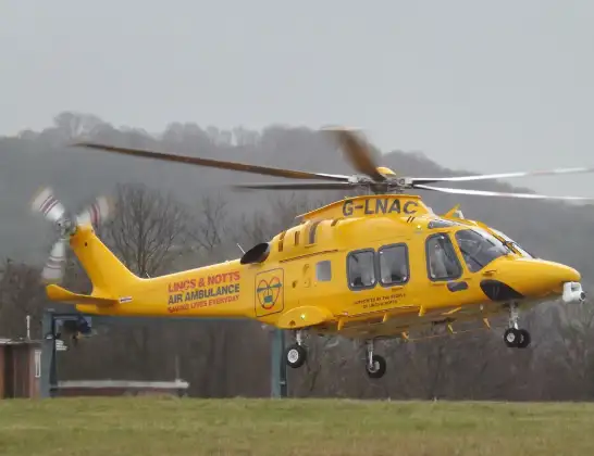
Helicopter: G-LNAC
The helicopter G-LNAC is used as a air ambulance helicopter. The main purpose of this aircraft is to transport a Mobile Medical Team to an incident as quickly as possible, enabling the trauma doctor to provide immediate first aid on site. The aircraft is flying this flight as Air Ambulance Helicopter.
Photo: James from Cheltenham, Gloucestershire
34 miles
1175 feet
119 mph
17 minutes
19:37
19:54

Route
Penenden Heath Road, Kent19:54
Penenden Heath Road, Kent19:53
Maidstone, Kent19:49
Royal British Legion Village, Kent19:49
East Malling, Kent19:48
Tonbridge and Malling, Kent19:48
Kings Hill, Kent19:48
RAF West Malling, West Malling, Kent19:48
Mereworth, Kent19:47
West Peckham, Kent19:47
Tonbridge and Malling, Kent19:46
Plaxtol, Kent19:46
Shipbourne, Kent19:45
Sevenoaks, Kent19:42
Tandridge, Surrey19:42
Merle Common, Surrey19:42
Oxted, Surrey19:41
South Godstone, Surrey19:40
Moats Lane, Surrey19:39
Redhill Aerodrome, Redhill, Surrey19:37
Live flights
Today
Flights Maidstone
Air Ambulance Helicopter to Redhill Aerodrome30 May 13:34
Coastguard Helicopter to Manston Airport21 May 16:28
Helicopter flights on your website?
You can easily display helicopter flights on your own website. Use the embed code.
