Police Helicopter to MOD St Athan
Thursday, 16 April 2026 | 11:30 | From Pum Heol / Five Roads
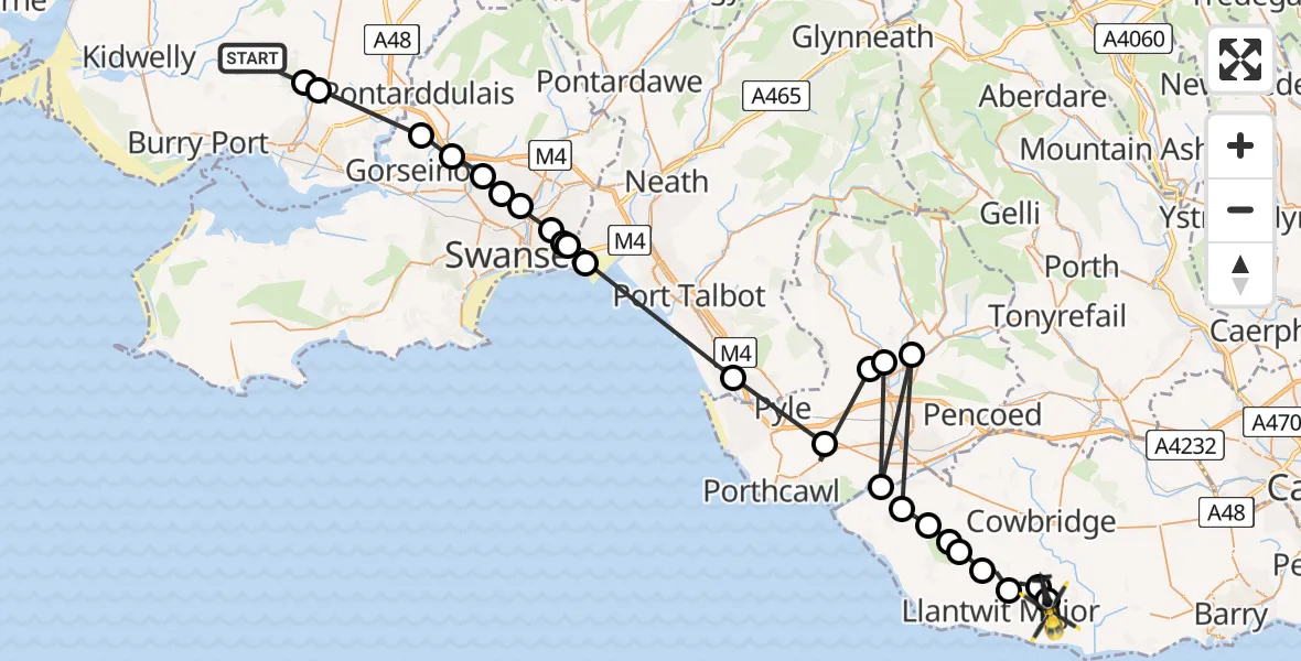
On Thursday, 16 April 2026 at 11:30, a Police Helicopter departed from Pum Heol / Five Roads to MOD St Athan. It was the Police Helicopter with registration number G-NWOI. The flight lasted 17 minutes. During that period, the aircraft travelled 59 miles at an average speed of 210 miles per hour at a maximum altitude of 1150 feet.

Helicopter: G-NWOI
The helicopter G-NWOI is used by the British police. The helicopter is deployed in pursuits, missing persons cases and other incidents where a helicopter provides added value.
Photo: Alec Wilson
59 miles
1150 feet
210 mph
17 minutes
11:30
11:47

Route
MOD St Athan, St Athan, Vale of Glamorgan11:47
MOD St Athan, St Athan, Vale of Glamorgan11:47
Eglwys Brewis, Vale of Glamorgan11:46
Sigingstone, Vale of Glamorgan11:46
Llantwit Major, Vale of Glamorgan11:45
Llandow, Vale of Glamorgan11:45
Wick, Vale of Glamorgan11:44
St. Brides Major, Vale of Glamorgan11:44
St Brides Major, Vale of Glamorgan11:43
Brynmenyn, Bridgend11:43
Ogmore, Vale of Glamorgan11:43
Coytrahen, Bridgend11:43
Tondu, Bridgend11:42
Tythegston, Bridgend11:42
Eglwys Nunydd Reservoir11:40
Coedffranc, Neath Port Talbot11:37
Winsh-wen, Swansea11:36
Port Tennant, Swansea11:36
Pentre'r-Gaseg, Swansea11:36
Plasmarl, Swansea11:35
Tirdeunaw, Swansea11:35
Penlan, Swansea11:34
Penllergaer, Swansea11:34
Gorseinon, Swansea11:33
Llanelli Rural, Carmarthenshire11:31
Swiss Valley, Carmarthenshire11:31
Pum Heol / Five Roads, Carmarthenshire11:30
Live flights
Today
Helicopter flights on your website?
You can easily display helicopter flights on your own website. Use the embed code.
