Police Helicopter to East Ardsley, Stoney Lane
Wednesday, 15 April 2026 | 19:47 | From East Ardsley
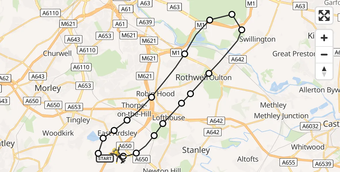
On Wednesday, 15 April 2026 at 19:47, a Police Helicopter departed from East Ardsley to East Ardsley. It was the Police Helicopter with registration number G-POLB. The flight lasted 7 minutes. During that period, the aircraft travelled 14 miles at an average speed of 116 miles per hour at a maximum altitude of 1600 feet.
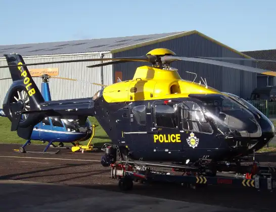
Helicopter: G-POLB
The helicopter G-POLB is used by the British police. The helicopter is deployed in pursuits, missing persons cases and other incidents where a helicopter provides added value.
Photo: James from Cheltenham, Gloucestershire
14 miles
1600 feet
116 mph
8 minutes
19:47
19:54

Route
Stoney Lane, West Yorkshire - Wakefield19:54
East Ardsley, Wakefield19:54
Carr Gate, Wakefield19:53
Lofthouse Gate, Wakefield19:53
Lofthouse, Leeds19:53
Carlton, Leeds19:52
Rothwell, Leeds19:52
Oulton, Leeds19:51
Swillington, Leeds19:50
Colton, Leeds19:50
Swillington, Leeds19:50
Rothwell, Leeds19:49
Robin Hood, Leeds19:49
Thorpe-on-the-Hill, Leeds19:48
East Ardsley, Leeds19:48
Tingley, Leeds19:48
East Ardsley, Leeds19:47
Woodhouse Lane, West Yorkshire - Leeds19:47
Live flights
Coastguard Helicopter on its way from Inner Seas15 Apr 23:27
Police Helicopter on its way from MOD St Athan15 Apr 23:04
Today
Police Helicopter to Rochester Airport15 Apr 23:44
Police Helicopter to Birmingham Airport15 Apr 23:35
Police Helicopter to North Weald Airfield15 Apr 23:26
Air Ambulance Helicopter to Glasgow Airport15 Apr 22:56
Police Helicopter to Rochester Airport15 Apr 22:24
Air Ambulance Helicopter to Inner Seas15 Apr 22:16
Helicopter flights on your website?
You can easily display helicopter flights on your own website. Use the embed code.
