Air Ambulance Helicopter to City of Nottingham, Autumn Way
Wednesday, 15 April 2026 | 11:21 | From Melton Mowbray
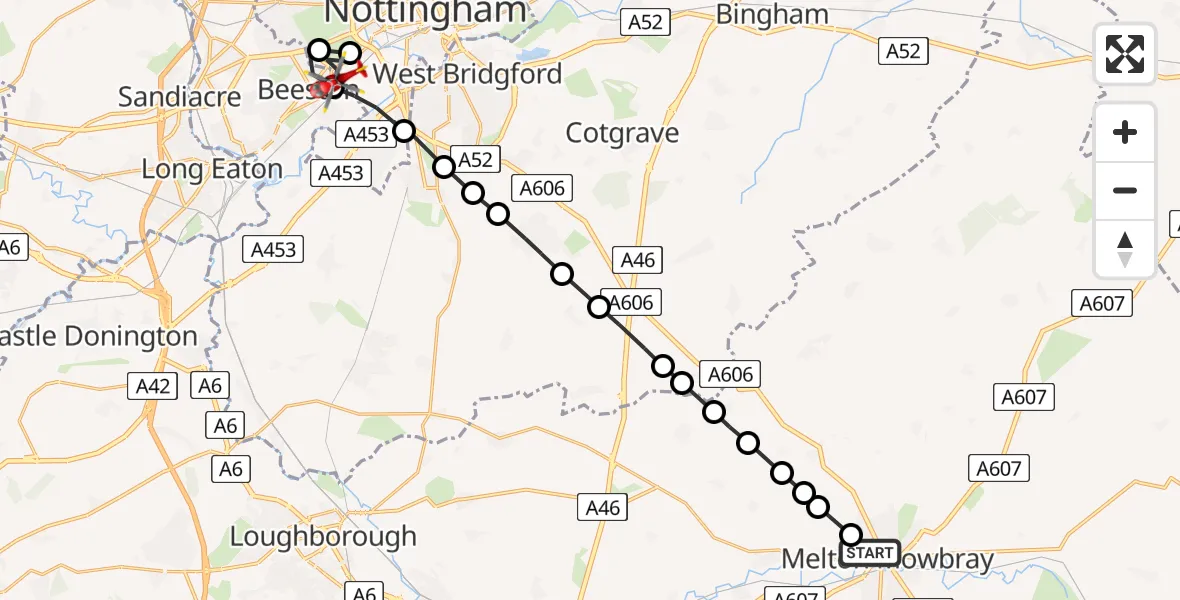
On Wednesday, 15 April 2026 at 11:21, a Air Ambulance Helicopter departed from Melton Mowbray to City of Nottingham. It was the Air Ambulance Helicopter with registration number G-DRLA. The flight lasted 8 minutes. During that period, the aircraft travelled 20 miles at an average speed of 154 miles per hour at a maximum altitude of 1050 feet.
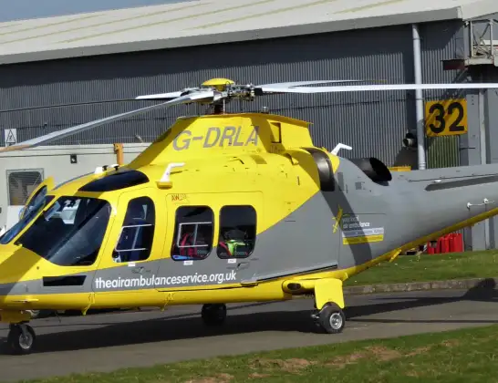
Helicopter: G-DRLA
The helicopter G-DRLA is used as an ambulance helicopter. The helicopter is equipped with a stretcher for transporting patients. The helicopter is often used to transport to hospitals.
Photo: Alec Wilson
21 miles
1050 feet
154 mph
8 minutes
11:21
11:29

Route
Autumn Way, Nottinghamshire11:29
City of Nottingham, Nottingham11:28
Wollaton, Nottingham11:27
Beeston, Nottinghamshire11:27
City of Nottingham, Nottingham11:26
West Bridgford, Nottinghamshire11:26
Ruddington, Nottinghamshire11:25
Bradmore, Nottinghamshire11:25
Keyworth, Nottinghamshire11:24
Widmerpool, Nottinghamshire11:24
Rushcliffe, Nottinghamshire11:23
Upper Broughton, Nottinghamshire11:23
Queensway Old Dalby, Leicestershire11:23
Wartnaby, Leicestershire11:22
Ab Kettleby, Leicestershire11:22
Wartnaby, Leicestershire11:22
Melton Mowbray, Leicestershire11:22
Sysonby, Leicestershire11:21
Stirling Road, Leicestershire11:21
Live flights
Today
Helicopter flights on your website?
You can easily display helicopter flights on your own website. Use the embed code.
