Air Ambulance Helicopter to Cirencester, Kingshill Lane
Wednesday, 15 April 2026 | 8:41 | From Wiltshire Air Ambulance
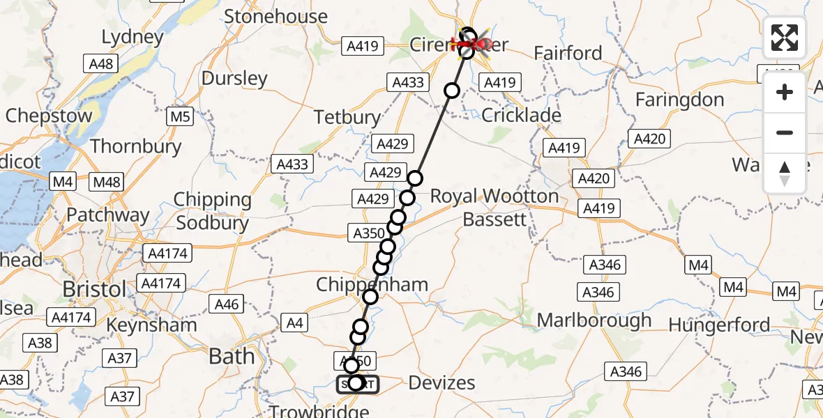
On Wednesday, 15 April 2026 at 8:41, a Air Ambulance Helicopter departed from Wiltshire Air Ambulance to Cirencester. It was the Air Ambulance Helicopter with registration number G-WLTS. The flight lasted 15 minutes. During that period, the aircraft travelled 31 miles at an average speed of 122 miles per hour at a maximum altitude of 1200 feet.
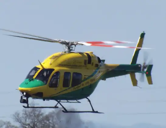
Helicopter: G-WLTS
The helicopter G-WLTS is used as a air ambulance helicopter. The main purpose of this aircraft is to transport a Mobile Medical Team to an incident as quickly as possible, enabling the trauma doctor to provide immediate first aid on site. The aircraft is flying this flight as Air Ambulance Helicopter.
Photo: James
31 miles
1200 feet
122 mph
16 minutes
08:41
08:56

Route
Cirencester, Gloucestershire08:56
Kingshill Lane, Gloucestershire08:56
Cirencester, Gloucestershire08:54
Baunton, Gloucestershire08:54
Cirencester, Gloucestershire08:51
Ewen, Gloucestershire08:50
Charlton, Wiltshire08:48
Little Somerford, Wiltshire08:47
Startley, Wiltshire08:47
Upper Seagry, Wiltshire08:46
Sutton Benger, Wiltshire08:46
Kington Langley, Wiltshire08:46
Langley Burrell, Wiltshire08:45
Chippenham, Wiltshire08:45
Lacock, Wiltshire08:44
Beanacre, Wiltshire08:44
Melksham, Wiltshire08:43
Berryfield, Wiltshire08:42
Commerce Way, Wiltshire08:42
Melksham, Wiltshire08:41
Wiltshire Air Ambulance08:41
Live flights
Police Helicopter on its way from Boverton9 Jul 23:41
Police Helicopter on its way from Strachan9 Jul 23:35
Police Helicopter on its way from Irlam9 Jul 22:15
Today
Police Helicopter to Culter9 Jul 23:28
Coastguard Helicopter to Solent Airport9 Jul 23:22
Coastguard Helicopter to North Sea9 Jul 22:25
Police Helicopter to Hortham, M59 Jul 22:22
Police Helicopter to MOD St Athan9 Jul 22:18
Coastguard Helicopter to North Sea9 Jul 22:15
Flights Cirencester
Air Ambulance Helicopter to Cirencester4 May 12:32
Helicopter flights on your website?
You can easily display helicopter flights on your own website. Use the embed code.
