Air Ambulance Helicopter to Patchway, Worthing Road
Tuesday, 14 April 2026 | 18:53 | From Bristol
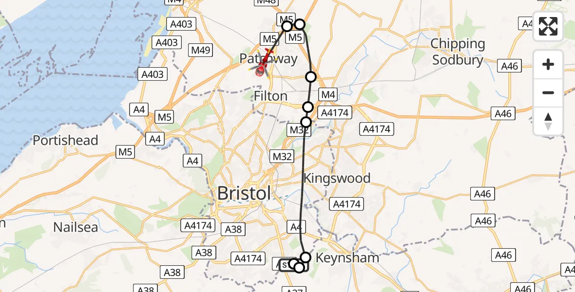
On Tuesday, 14 April 2026 at 18:53, a Air Ambulance Helicopter departed from Bristol to Patchway. It was the Air Ambulance Helicopter with registration number G-GWAC. The flight lasted 6 minutes. During that period, the aircraft travelled 13 miles at an average speed of 126 miles per hour at a maximum altitude of 925 feet.
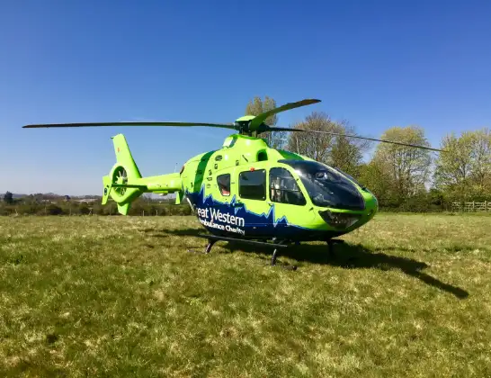
Helicopter: G-GWAC
The helicopter G-GWAC is used as a air ambulance helicopter. The main purpose of this aircraft is to transport a Mobile Medical Team to an incident as quickly as possible, enabling the trauma doctor to provide immediate first aid on site. The aircraft is flying this flight as Air Ambulance Helicopter.
Photo: Mojo0306
14 miles
925 feet
126 mph
7 minutes
18:53
19:00

Route
Worthing Road, South Gloucestershire19:00
Almondsbury Helicopter Base, Bristol, Somerset19:00
Almondsbury Helicopter Base, Bristol, Somerset18:59
Woodlands, South Gloucestershire18:58
Bradley Stoke, South Gloucestershire18:57
Harry Stoke, South Gloucestershire18:57
Bristol, South Gloucestershire18:57
Bristol, Bristol, City of18:54
Stockwood Lane, Bath and North East Somerset18:54
Bristol, Bristol, City of18:54
Bristol, Bath and North East Somerset18:53
Today
Police Helicopter to Falkirk02:12:08
Flights Patchway
Police Helicopter to Patchway, Over Lane27 Jun 23:34
Police Helicopter to Patchway, M525 Jun 12:28
Police Helicopter to Bristol, Abbotsford Road16 Jun 10:38
Police Helicopter to Almondsbury Helicopter Base16 Jun 08:21
Police Helicopter to Almondsbury Helicopter Base30 May 11:13
Flights Bristol
Police Helicopter to Bristol, Diana Gardens14 Jul 00:58
Police Helicopter to Bristol, Oaktree Crescent10 Jul 12:36
Police Helicopter to Bristol, Stoke Lane9 Jul 20:52
Helicopter flights on your website?
You can easily display helicopter flights on your own website. Use the embed code.
