Air Ambulance Helicopter to Stokesley, Eastfields
Tuesday, 14 April 2026 | 16:07 | From RAF Topcliffe
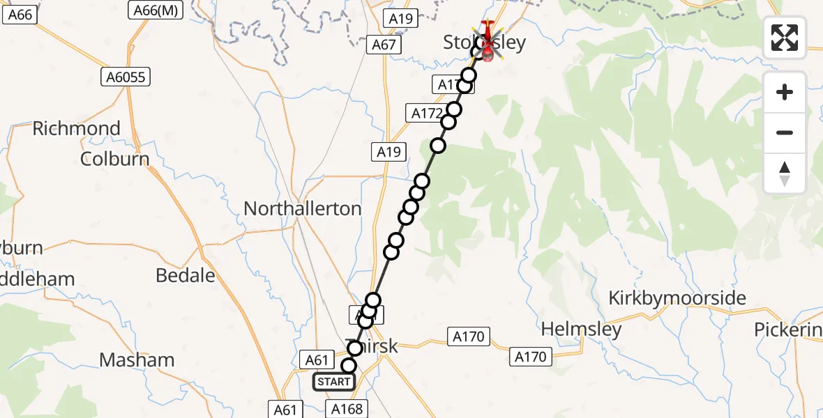
On Tuesday, 14 April 2026 at 16:07, a Air Ambulance Helicopter departed from RAF Topcliffe to Stokesley. It was the Air Ambulance Helicopter with registration number G-YORX. The flight lasted 10 minutes. During that period, the aircraft travelled 22 miles at an average speed of 128 miles per hour at a maximum altitude of 1675 feet.
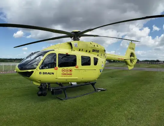
Helicopter: G-YORX
The helicopter G-YORX is used as a air ambulance helicopter. The main purpose of this aircraft is to transport a Mobile Medical Team to an incident as quickly as possible, enabling the trauma doctor to provide immediate first aid on site. The aircraft is flying this flight as Air Ambulance Helicopter.
Photo: Arollin96227
23 miles
1675 feet
128 mph
11 minutes
16:07
16:17

Route
Eastfields, North Yorkshire16:17
Stokesley, North Yorkshire16:16
Kirkby, North Yorkshire16:15
Great Busby, North Yorkshire16:15
Carlton in Cleveland, North Yorkshire16:15
Faceby, North Yorkshire16:14
Whorlton, North Yorkshire16:14
Swainby, North Yorkshire16:13
Osmotherley, North Yorkshire16:13
Thimbleby, North Yorkshire16:12
Nether Silton, North Yorkshire16:12
Over Silton, North Yorkshire16:12
Nether Silton, North Yorkshire16:11
Kepwick, North Yorkshire16:11
Knayton, North Yorkshire16:10
Thornbrough, North Yorkshire16:10
South Kilvington, North Yorkshire16:10
Thirsk, North Yorkshire16:09
Sowerby, North Yorkshire16:08
RAF Topcliffe, Thirsk, North Yorkshire16:08
RAF Topcliffe, Thirsk, North Yorkshire16:07
Live flights
Today
Police Helicopter to Haydon14 Apr 23:35
Police Helicopter to East Ardsley, Stoney Lane14 Apr 22:38
Police Helicopter to North Weald Airfield14 Apr 22:10
Coastguard Helicopter to Mealabost, Steinis14 Apr 21:51
Air Ambulance Aircraft to Cothal, Pitmedden Road14 Apr 21:44
Coastguard Helicopter to Mealabost14 Apr 21:36
Coastguard Helicopter to Inner Seas14 Apr 21:22
Police Helicopter to North Weald Airfield14 Apr 21:14
Flights Stokesley
Helicopter flights on your website?
You can easily display helicopter flights on your own website. Use the embed code.
