Air Ambulance Helicopter to Royal Preston
Tuesday, 14 April 2026 | 14:14 | From Irish Sea
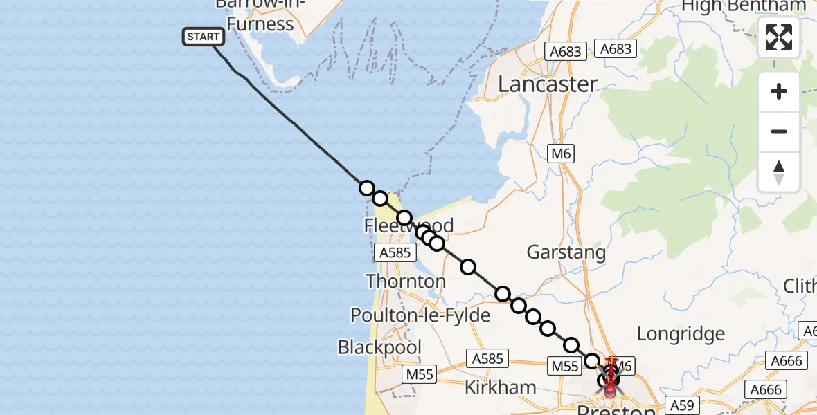
On Tuesday, 14 April 2026 at 14:14, a Air Ambulance Helicopter departed from Irish Sea to Royal Preston. It was the Air Ambulance Helicopter with registration number G-NHAE. The flight lasted 16 minutes. During that period, the aircraft travelled 34 miles at an average speed of 130 miles per hour at a maximum altitude of 1150 feet.
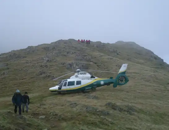
Helicopter: G-NHAE
The helicopter G-NHAE is used as a air ambulance helicopter. The main purpose of this aircraft is to transport a Mobile Medical Team to an incident as quickly as possible, enabling the trauma doctor to provide immediate first aid on site. The aircraft is flying this flight as Air Ambulance Helicopter.
Photo: Michael Earnshaw
34 miles
1150 feet
130 mph
16 minutes
14:14
14:30

Route
Royal Preston, Preston14:30
Royal Preston, Preston14:30
Broughton, Lancashire14:29
Preston, Lancashire14:29
Royal Preston, Preston14:28
Broughton, Lancashire14:28
Woodplumpton, Lancashire14:27
Catforth, Lancashire14:26
Inskip, Lancashire14:26
Wyre, Lancashire14:25
Great Eccleston, Lancashire14:25
Wyre, Lancashire14:24
Stalmine, Lancashire14:22
Preesall, Lancashire14:22
Knott End-On-Sea, Lancashire14:22
Fleetwood, Lancashire14:21
Wyre, Lancashire14:21
Fleetwood, Lancashire14:20
Irish Sea, 14:14
Live flights
Police Helicopter on its way from East Ardsley14 Apr 22:38
Today
Coastguard Helicopter to Mealabost, Steinis14 Apr 21:51
Air Ambulance Aircraft to Cothal, Pitmedden Road14 Apr 21:44
Coastguard Helicopter to Mealabost14 Apr 21:36
Coastguard Helicopter to Inner Seas14 Apr 21:22
Police Helicopter to North Weald Airfield14 Apr 21:14
Air Ambulance Helicopter to RAF Northolt14 Apr 21:00
Coastguard Helicopter to Inner Seas14 Apr 20:33
Police Helicopter to Sewardstonebury, Green Lane14 Apr 20:31
Police Helicopter to Harborough, Sulby Road14 Apr 20:22
Helicopter flights on your website?
You can easily display helicopter flights on your own website. Use the embed code.
