Air Ambulance Helicopter to Henstridge Airfield
Tuesday, 14 April 2026 | 1:38 | From Bournemouth
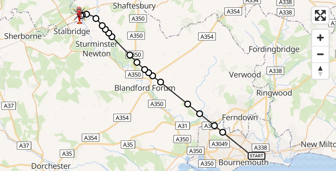
On Tuesday, 14 April 2026 at 1:38, a Air Ambulance Helicopter departed from Bournemouth to Henstridge Airfield. It was the Air Ambulance Helicopter with registration number G-DSAA. The flight lasted 19 minutes. During that period, the aircraft travelled 29 miles at an average speed of 93 miles per hour at a maximum altitude of 1425 feet.
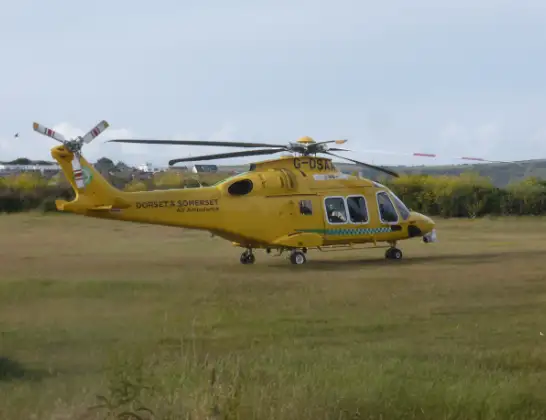
Helicopter: G-DSAA
The helicopter G-DSAA is used as a air ambulance helicopter. The main purpose of this aircraft is to transport a Mobile Medical Team to an incident as quickly as possible, enabling the trauma doctor to provide immediate first aid on site. The aircraft is flying this flight as Air Ambulance Helicopter.
Photo: Andrew Bone
30 miles
1425 feet
93 mph
19 minutes
01:38
01:57

Route
Henstridge Airfield, Templecombe, Somerset01:57
Henstridge Airfield, Templecombe, Somerset01:56
Henstridge Airfield, Templecombe, Somerset01:55
Kington Magna, Dorset01:55
West Stour, Dorset01:54
Fifehead Magdalen, Dorset01:53
Todber, Dorset01:53
Margaret Marsh, Dorset01:53
Todber, Dorset01:52
West Orchard, Dorset01:52
Child Okeford, Dorset01:51
Shroton, Dorset01:50
Stourpaine, Dorset01:50
Blandford Forum, Dorset01:50
Pimperne, Dorset01:49
Blandford Camp, Dorset01:49
Tarrant Rushton, Dorset01:47
Pamphill, Dorset01:46
Wimborne Minster, Dorset01:45
Poole, Bournemouth, Christchurch and Poole01:45
Malmesbury Park Road, Bournemouth, Christchurch and Poole01:43
Bournemouth, Bournemouth, Christchurch and Poole01:38
Live flights
Police Helicopter on its way from RAF Benson12 Jul 22:54
Police Helicopter on its way from Dundrod12 Jul 22:50
Police Helicopter on its way from East Ardsley12 Jul 22:44
Today
Air Ambulance Helicopter to Glasgow Airport12 Jul 22:48
Air Ambulance Helicopter to Norwich Airport12 Jul 22:27
Air Ambulance Helicopter to Northrepps Aerodrome12 Jul 22:23
Police Helicopter to Harborough, Sulby Road12 Jul 22:20
Air Ambulance Helicopter to Derriford Hospital12 Jul 22:12
Police Helicopter to Manchester Barton Aerodrome12 Jul 22:11
Air Ambulance Helicopter to Northrepps Aerodrome12 Jul 22:03
Flights Bournemouth
Police Helicopter to Parley Cross, Parley Lane12 Jul 16:42
Police Helicopter to Bournemouth Airport8 Jul 16:52
Police Helicopter to Bournemouth Airport6 Jul 18:13
Police Helicopter to Bournemouth Airport30 Jun 14:17
Police Helicopter to Bournemouth Airport23 Jun 16:37
Helicopter flights on your website?
You can easily display helicopter flights on your own website. Use the embed code.
