Coastguard Helicopter to Caernarfon Airport
Sunday, 12 April 2026 | 20:52 | From Irish Sea
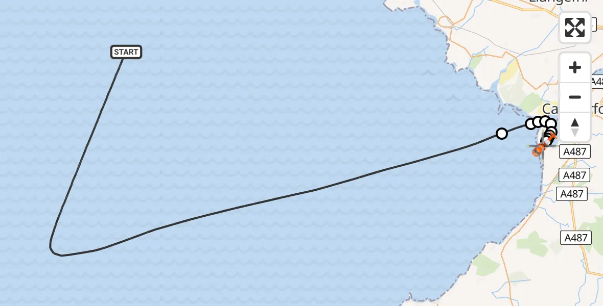
On Sunday, 12 April 2026 at 20:52, a Coastguard Helicopter departed from Irish Sea to Caernarfon Airport. It was the Coastguard Helicopter with registration number G-MCGI. The flight lasted 61 minutes. During that period, the aircraft travelled 55 miles at an average speed of 54 miles per hour at a maximum altitude of 1250 feet.
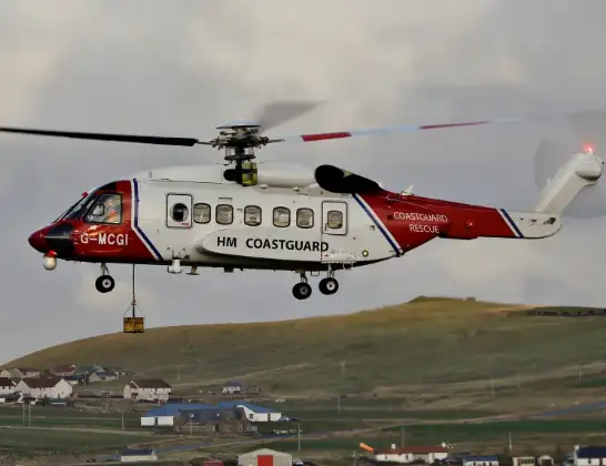
Helicopter: G-MCGI
The helicopter G-MCGI is used by the British Coastguard. The helicopter is deployed in search and rescue operations at sea, rescue operations involving ships or drilling platforms, patrols to prevent smuggling or piracy, environmental monitoring and disaster relief support.
Photo: CG Rescue G-MCGI MG 0869.jpg by Ronnie Robertson Licensed under CC BY-SA 2.0 Source: https://commons.wikimedia.org/wiki/File:CG_Rescue_G-MCGI_MG_0869.jpg
55 miles
1250 feet
54 mph
62 minutes
20:52
21:53

Route
Caernarfon Airport, Caernarfon21:53
Caernarfon Airport, Caernarfon21:52
Caernarfon Airport, Caernarfon21:51
Llanfaglan, Gwynedd21:51
Llandwrog, Gwynedd21:50
Bontnewydd, Gwynedd21:50
Llanfaglan, Gwynedd21:50
Pen-Lôn21:49
Llandwrog, Gwynedd21:49
Pen-Lôn21:49
21:48
Irish Sea, 20:52
Live flights
Today
Helicopter flights on your website?
You can easily display helicopter flights on your own website. Use the embed code.
