Air Ambulance Helicopter to Hill Croome, M5
Sunday, 12 April 2026 | 14:42 | From Queen Elizabeth Hospital Helipad
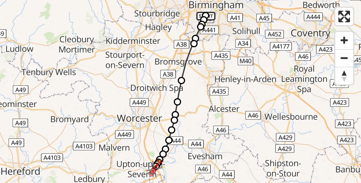
On Sunday, 12 April 2026 at 14:42, a Air Ambulance Helicopter departed from Queen Elizabeth Hospital Helipad to Hill Croome. It was the Air Ambulance Helicopter with registration number G-OMAA. The flight lasted 41 minutes. During that period, the aircraft travelled 29 miles at an average speed of 43 miles per hour at a maximum altitude of 1675 feet.
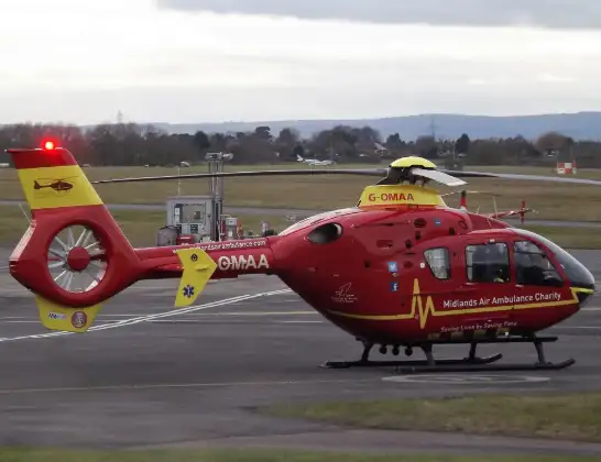
Helicopter: G-OMAA
The helicopter G-OMAA is used as a air ambulance helicopter. The main purpose of this aircraft is to transport a Mobile Medical Team to an incident as quickly as possible, enabling the trauma doctor to provide immediate first aid on site. The aircraft is flying this flight as Air Ambulance Helicopter.
Photo: James from Cheltenham, Gloucestershire
29 miles
1675 feet
43 mph
41 minutes
14:42
15:23

Route
M5, West Midlands - Worcestershire15:23
Hill Croome, Worcestershire15:22
Upper Strensham, Worcestershire15:22
Defford, Worcestershire15:22
Croft Farm Airfield, Worcester, Worcestershire15:21
Defford, Worcestershire15:21
Wychavon, Worcestershire15:21
Drakes Broughton, Worcestershire15:20
Peopleton, Worcestershire15:19
Upton Snodsbury, Worcestershire15:18
Wychavon, Worcestershire15:18
Himbleton, Worcestershire15:17
Hanbury, Worcestershire15:15
Bromsgrove, Worcestershire15:12
Rednal, Birmingham15:11
Turves Green, Birmingham15:10
Shenley Fields, Birmingham15:10
Selly Oak, Birmingham15:09
Bourn Brook Walkway, West Midlands - Birmingham15:09
Metchley, Birmingham15:09
Queen Elizabeth Hospital Helipad, Birmingham14:42
Live flights
Today
Helicopter flights on your website?
You can easily display helicopter flights on your own website. Use the embed code.
