Police Helicopter to Benson, The Sands
Sunday, 12 April 2026 | 14:25 | From Shillingford
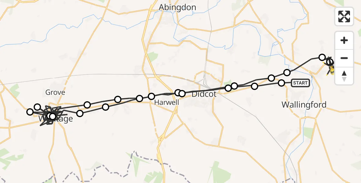
On Sunday, 12 April 2026 at 14:25, a Police Helicopter departed from Shillingford to Benson. It was the Police Helicopter with registration number G-POLF. The flight lasted 37 minutes. During that period, the aircraft travelled 59 miles at an average speed of 98 miles per hour at a maximum altitude of 1400 feet.
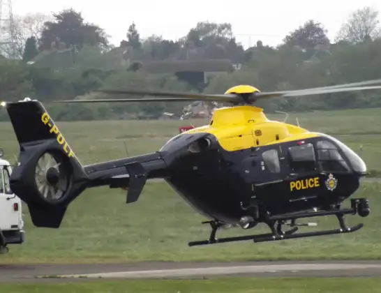
Helicopter: G-POLF
The helicopter G-POLF is used by the British police. The helicopter is deployed in pursuits, missing persons cases and other incidents where a helicopter provides added value.
Photo: James
60 miles
1400 feet
98 mph
37 minutes
14:25
15:02

Route
The Sands, Oxfordshire15:02
Benson, Oxfordshire15:02
Berrick Salome, Oxfordshire15:01
Shillingford, Oxfordshire15:01
Brightwell-cum-Sotwell, Oxfordshire15:00
North Moreton, Oxfordshire15:00
Didcot, Oxfordshire14:59
Harwell, Oxfordshire14:58
East Hendred, Oxfordshire14:57
Ardington, Oxfordshire14:57
Wantage, Oxfordshire14:38
East Challow, Oxfordshire14:38
Wantage, Oxfordshire14:38
East Challow, Oxfordshire14:37
Wantage, Oxfordshire14:31
Ardington, Oxfordshire14:30
East Hendred, Oxfordshire14:29
Harwell, Oxfordshire14:28
Didcot, Oxfordshire14:27
North Moreton, Oxfordshire14:26
Brightwell-cum-Sotwell, Oxfordshire14:26
Shillingford Road, Oxfordshire14:25
Live flights
Today
Flights Benson
Air Ambulance Helicopter to Benson10 Jul 09:43
Police Helicopter to Benson, Clack's Lane2 Jul 19:06
Police Helicopter to Benson, A41301 Jul 15:27
Police Helicopter to Benson, Braze Lane1 Jul 13:48
Police Helicopter to RAF Benson30 Jun 19:42
Police Helicopter to Benson, The Sands30 Jun 15:07
Police Helicopter to Benson, The Sands28 Jun 21:41
Police Helicopter to Benson, Clack's Lane28 Jun 17:16
Police Helicopter to RAF Benson27 Jun 19:48
Flights Shillingford
Police Helicopter to Benson, Braze Lane1 Jul 13:48
Police Helicopter to Benson, Brook Street8 Jun 20:13
Police Helicopter to Buckland30 May 13:51
Police Helicopter to Benson, Brook Street29 May 19:59
Police Helicopter to Oxford, Banbury Road3 May 15:08
Police Helicopter to Benson, The Sands26 Apr 18:49
Police Helicopter to RAF Benson17 Apr 15:46
Police Helicopter to Ewelme, The Sands15 Apr 21:09
Police Helicopter to Ewelme, Braze Lane14 Apr 17:31
Helicopter flights on your website?
You can easily display helicopter flights on your own website. Use the embed code.
