Police Helicopter to Tandridge, Kings Cross Lane
Saturday, 11 April 2026 | 18:01 | From South Nutfield
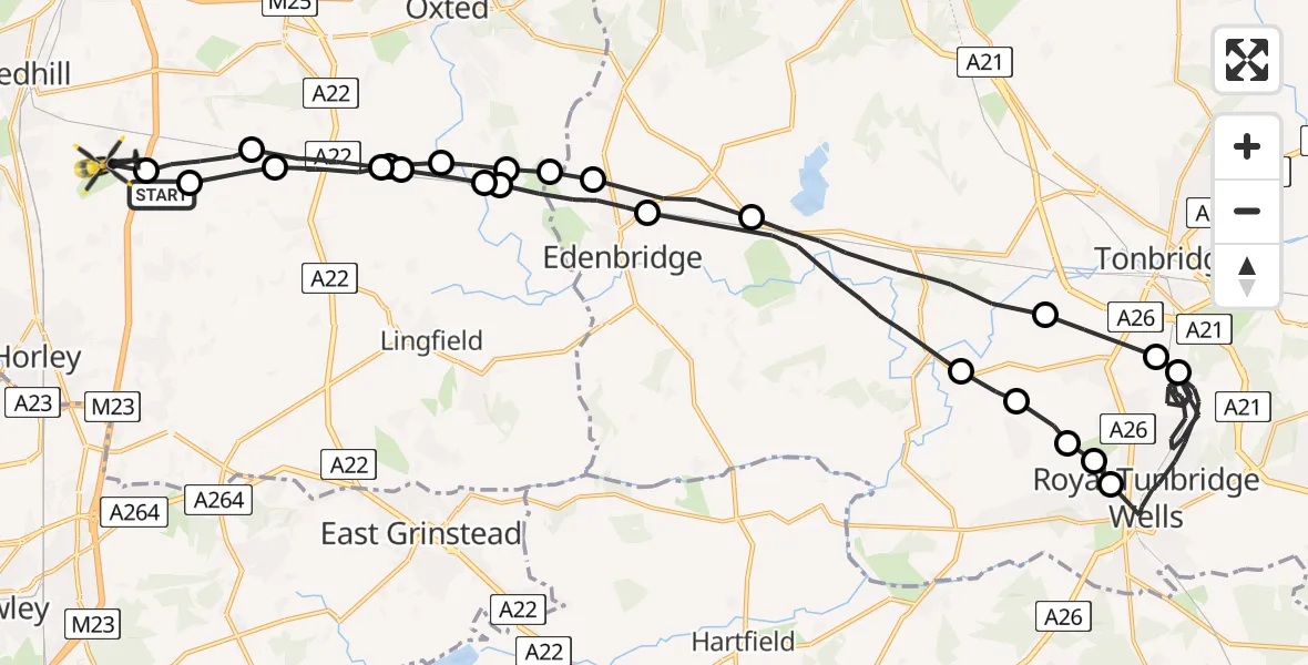
On Saturday, 11 April 2026 at 18:01, a Police Helicopter departed from South Nutfield to Tandridge. It was the Police Helicopter with registration number G-POLH. The flight lasted 24 minutes. During that period, the aircraft travelled 45 miles at an average speed of 115 miles per hour at a maximum altitude of 1400 feet.
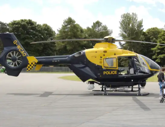
Helicopter: G-POLH
The helicopter G-POLH is used by the British police. The helicopter is deployed in pursuits, missing persons cases and other incidents where a helicopter provides added value.
Photo: Arpingstone
46 miles
1400 feet
115 mph
24 minutes
18:01
18:24

Route
Kings Cross Lane, Surrey18:24
South Nutfield, Surrey18:24
Tandridge, Surrey18:23
South Godstone, Surrey18:22
Crowhurst, Surrey18:22
Oxted, Surrey18:22
Merle Common, Surrey18:21
Edenbridge, Kent18:20
Sevenoaks, Kent18:17
Bidborough, Kent18:17
Speldhurst, Kent18:16
Southborough, Kent18:16
Rusthall, Kent18:16
Royal Tunbridge Wells, Kent18:08
Southborough, Kent18:07
Bidborough, Kent18:07
Sevenoaks, Kent18:05
Edenbridge, Kent18:04
Tandridge, Surrey18:03
Merle Common, Surrey18:03
Oxted, Surrey18:03
Crowhurst, Surrey18:02
South Godstone, Surrey18:02
Tandridge, Surrey18:01
Coopers Hill Road, Surrey18:01
Today
Flights Tandridge
Police Helicopter to Salfords, Cross Oak Lane31 May 19:55
Helicopter flights on your website?
You can easily display helicopter flights on your own website. Use the embed code.
