Coastguard Helicopter to Buckie Loch
Saturday, 11 April 2026 | 16:47 | From Inverness Airport
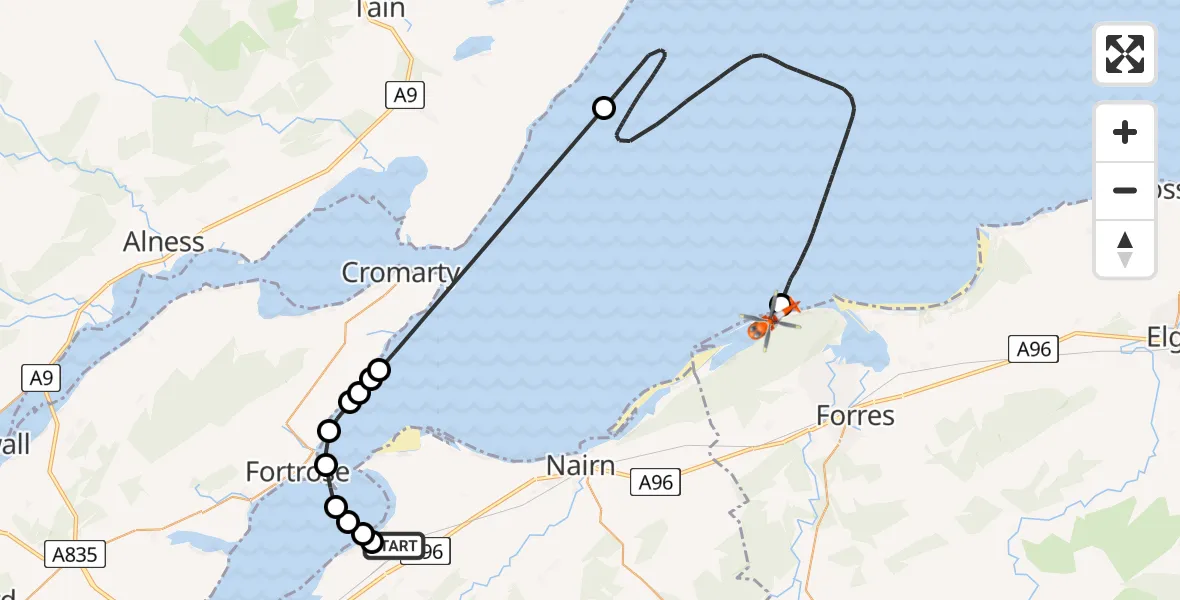
On Saturday, 11 April 2026 at 16:47, a Coastguard Helicopter departed from Inverness Airport to Buckie Loch. It was the Coastguard Helicopter with registration number G-MCGX. The flight lasted 36 minutes. During that period, the aircraft travelled 45 miles at an average speed of 76 miles per hour at a maximum altitude of 2650 feet.
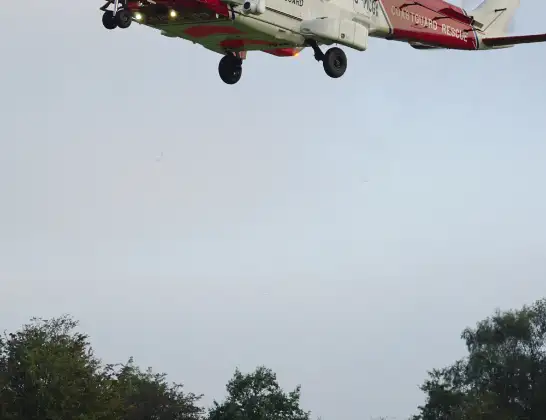
Helicopter: G-MCGX
The helicopter G-MCGX is used by the British Coastguard. The helicopter is deployed in search and rescue operations at sea, rescue operations involving ships or drilling platforms, patrols to prevent smuggling or piracy, environmental monitoring and disaster relief support.
Photo: Nick (UK)
45 miles
2650 feet
76 mph
36 minutes
16:47
17:22

Route
Buckie Loch, Moray17:22
Buckie Loch, Moray17:22
Buckie Loch, Moray17:21
Buckie Loch, Moray17:21
Buckie Loch, Moray17:20
Buckie Loch, Moray17:20
Buckie Loch, Moray17:18
Buckie Loch, Moray17:18
Buckie Loch, Moray17:18
Buckie Loch, Moray17:17
North Sea, 17:15
North Sea, 17:15
North Sea, 17:14
North Sea16:57
Cromarty, Highland16:52
Cromarty, Highland16:52
Eathie Hill, Highland16:52
Craighead, Highland16:51
Learnie Hill, Highland16:51
Brown Hill, Highland16:51
Easter Balmungie, Highland16:51
Rosemarkie, Highland16:50
Ness Road East, Highland16:50
Ness Road, Highland16:50
Fortrose, Highland16:49
Inverness, Highland16:49
Ardersier, Highland16:49
Inverness, Highland16:49
Inverness Airport, Inverness16:47
Live flights
Today
Helicopter flights on your website?
You can easily display helicopter flights on your own website. Use the embed code.
