Air Ambulance Helicopter to High Lorton, B5289
Saturday, 11 April 2026 | 14:29 | From Penrith
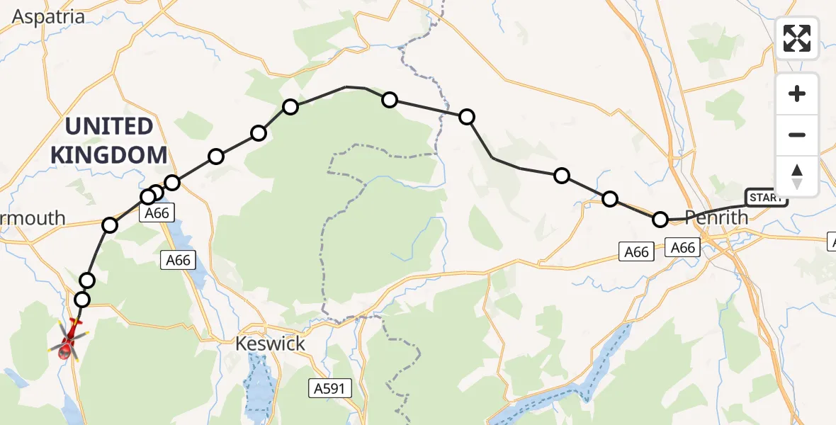
On Saturday, 11 April 2026 at 14:29, a Air Ambulance Helicopter departed from Penrith to High Lorton. It was the Air Ambulance Helicopter with registration number G-NHAE. The flight lasted 14 minutes. During that period, the aircraft travelled 30 miles at an average speed of 132 miles per hour at a maximum altitude of 2950 feet.
Helicopter: G-NHAE
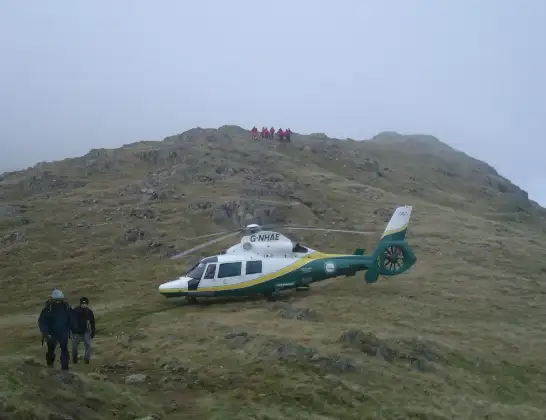
The helicopter G-NHAE is used as a air ambulance helicopter. The main purpose of this aircraft is to transport a Mobile Medical Team to an incident as quickly as possible, enabling the trauma doctor to provide immediate first aid on site. The aircraft is flying this flight as Air Ambulance Helicopter.
Photo: Michael Earnshaw
30 miles
2950 feet
132 mph
14 minutes
14:29
14:42

Route
B5289, Cumberland14:42
High Lorton, Cumberland14:42
Lorton, Cumberland14:41
Embleton, Cumberland14:40
Blindcrake, Cumberland14:39
Bassenthwaite Lake14:39
Blindcrake, Cumberland14:39
Bassenthwaite, Cumberland14:38
Uldale, Cumberland14:37
Ireby and Uldale, Cumberland14:36
Caldbeck, Cumberland14:35
Mungrisdale, Westmorland and Furness14:34
Greystoke, Westmorland and Furness14:32
Great Blencow, Westmorland and Furness14:31
Newbiggin, Westmorland and Furness14:31
Beacon Edge, Westmorland and Furness14:29
Live flights
Police Helicopter on its way from Renfrew15 Jul 23:02
Today
Air Ambulance Helicopter to Dunkeswell Airfield15 Jul 23:01
Police Helicopter to Manchester Barton Aerodrome15 Jul 22:25
Police Helicopter to Baxterley Aerodrome15 Jul 22:24
Air Ambulance Helicopter to Henstridge Airfield15 Jul 22:14
Coastguard Helicopter to Argyll and Bute, B84515 Jul 22:05
Police Helicopter to MOD St Athan15 Jul 21:51
Flights Penrith
Air Ambulance Helicopter to Penrith, A68614 Jul 14:59
Air Ambulance Helicopter to Stainton14 Jul 14:43
Air Ambulance Helicopter to Greystoke13 Jul 11:19
Air Ambulance Helicopter to Langwathby12 Jul 16:53
Air Ambulance Helicopter to Branthwaite9 Jul 13:23
Air Ambulance Helicopter to Penrith, M68 Jul 16:30
Air Ambulance Helicopter to Penrith, A6867 Jun 11:35
Air Ambulance Helicopter to Irish Sea5 Jun 15:10
Helicopter flights on your website?
You can easily display helicopter flights on your own website. Use the embed code.
