Coastguard Helicopter to Kirkbride Airfield
Saturday, 11 April 2026 | 14:15 | From Irish Sea
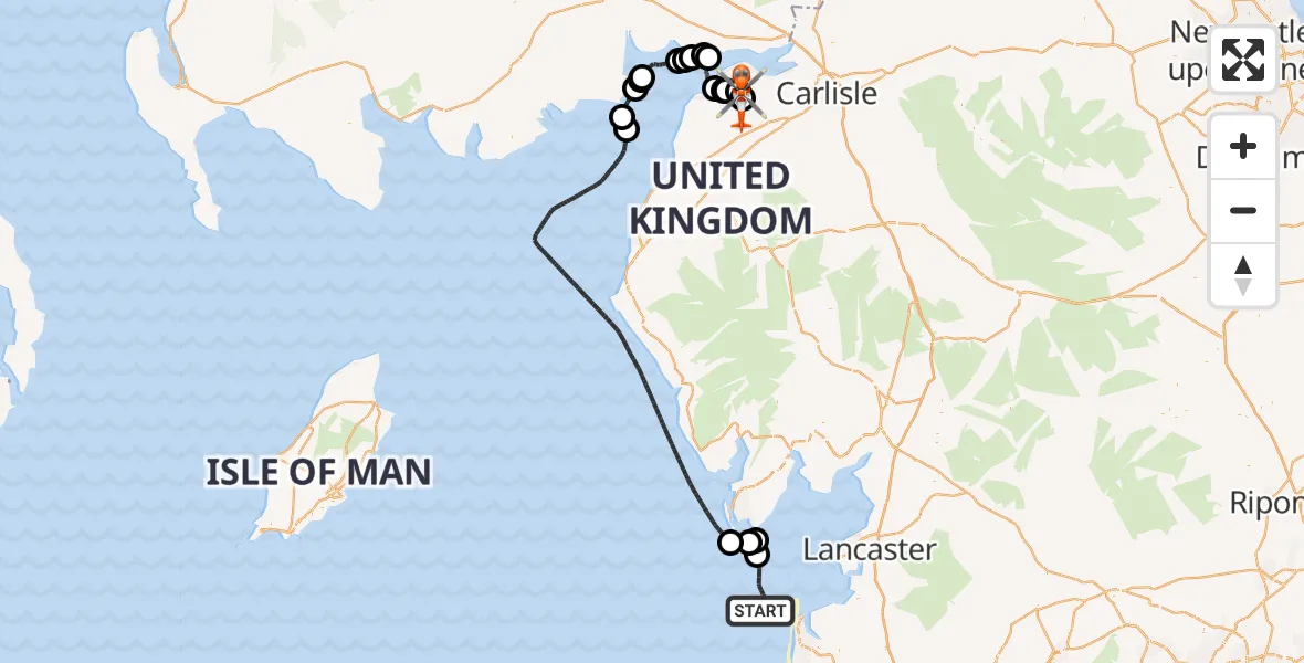
On Saturday, 11 April 2026 at 14:15, a Coastguard Helicopter departed from Irish Sea to Kirkbride Airfield. It was the Coastguard Helicopter with registration number G-MCGO. The flight lasted 80 minutes. During that period, the aircraft travelled 105 miles at an average speed of 80 miles per hour at a maximum altitude of 1350 feet.
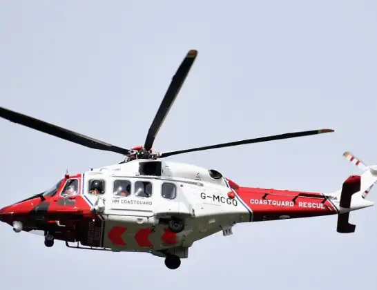
Helicopter: G-MCGO
The helicopter G-MCGO is used by the British Coastguard. The helicopter is deployed in search and rescue operations at sea, rescue operations involving ships or drilling platforms, patrols to prevent smuggling or piracy, environmental monitoring and disaster relief support.
Photo: Alec Wilson
106 miles
1350 feet
80 mph
80 minutes
14:15
15:34

Route
Kirkbride Airfield, Wigton, Cumbria15:34
Kirkbride Airfield, Wigton, Cumbria15:20
Kirkbride Airfield, Wigton, Cumbria15:18
Kirkbride Airfield, Wigton, Cumbria15:18
Kirkbride, Cumberland15:17
Holme East Waver, Cumberland15:16
Anthorn, Cumberland15:16
Holme East Waver, Cumberland15:15
Bowness, Cumberland15:10
Powfoot, Dumfries and Galloway15:09
Cummertrees, Dumfries and Galloway15:08
Dumfries and Galloway, Dumfries and Galloway15:08
Ruthwell, Dumfries and Galloway15:07
Dumfries and Galloway, Dumfries and Galloway15:04
Barbara Channel15:04
Boron point, Dumfries and Galloway15:03
Dumfries Channel15:01
15:01
Irish Sea14:34
Barrow, Westmorland and Furness14:33
Roa Island, Westmorland and Furness14:22
Barrow, Westmorland and Furness14:21
Irish Sea, 14:15
Live flights
Today
Helicopter flights on your website?
You can easily display helicopter flights on your own website. Use the embed code.
