Police Helicopter to Bristol Channel
Saturday, 11 April 2026 | 13:28 | From MOD St Athan
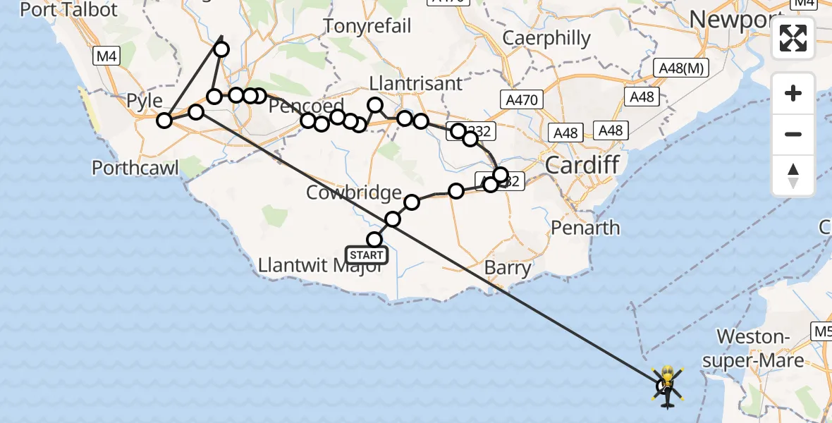
On Saturday, 11 April 2026 at 13:28, a Police Helicopter departed from MOD St Athan to Bristol Channel. It was the Police Helicopter with registration number G-NWOI. The flight lasted 22 minutes. During that period, the aircraft travelled 65 miles at an average speed of 177 miles per hour at a maximum altitude of 1425 feet.
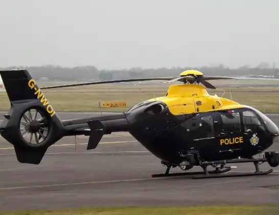
Helicopter: G-NWOI
The helicopter G-NWOI is used by the British police. The helicopter is deployed in pursuits, missing persons cases and other incidents where a helicopter provides added value.
Photo: James from Cheltenham
66 miles
1425 feet
177 mph
23 minutes
13:28
13:50

Route
Bristol Channel, 13:50
Bristol Channel13:50
Cefn Cribwr, Bridgend13:43
Pyle, Bridgend13:42
Coytrahen, Bridgend13:41
Aberkenfig, Bridgend13:41
Pen-y-fai, Bridgend13:40
Bridgend, Bridgend13:40
Coity, Bridgend13:39
Pencoed, Bridgend13:38
Llanilid, Rhondda Cynon Taf13:37
Brynsadler, Rhondda Cynon Taf13:37
Llanharry, Rhondda Cynon Taf13:36
Brynsadler, Rhondda Cynon Taf13:36
Llanharry, Rhondda Cynon Taf13:36
Brynsadler, Rhondda Cynon Taf13:35
Miskin, Rhondda Cynon Taf13:34
Peterston-super-Ely, Vale of Glamorgan13:34
St. Fagans, Cardiff13:33
St Fagans, Cardiff13:32
Michaelston-super-Ely, Cardiff13:31
St Nicholas, Vale of Glamorgan13:30
Bonvilston, Vale of Glamorgan13:29
St Hilary, Vale of Glamorgan13:29
St Mary Church, Vale of Glamorgan13:28
MOD St Athan, St Athan, Vale of Glamorgan13:28
Live flights
Today
Helicopter flights on your website?
You can easily display helicopter flights on your own website. Use the embed code.
