Air Ambulance Helicopter to Preston, Sharoe Green Lane
Saturday, 11 April 2026 | 10:29 | From Kirkby Ireleth
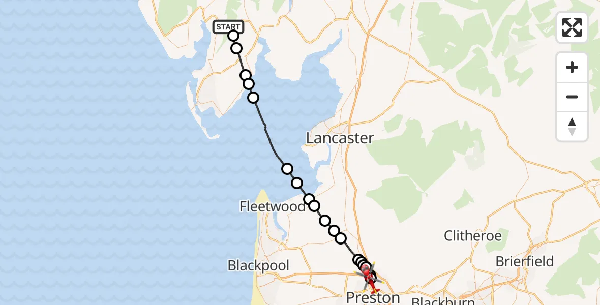
On Saturday, 11 April 2026 at 10:29, a Air Ambulance Helicopter departed from Kirkby Ireleth to Preston. It was the Air Ambulance Helicopter with registration number G-NWAA. The flight lasted 18 minutes. During that period, the aircraft travelled 37 miles at an average speed of 126 miles per hour at a maximum altitude of 2150 feet.
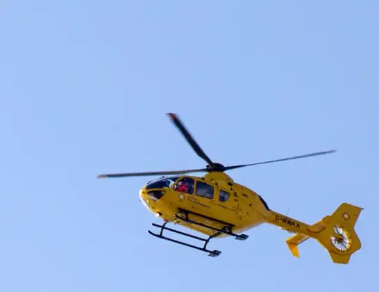
Helicopter: G-NWAA
The helicopter G-NWAA is used as a air ambulance helicopter. The main purpose of this aircraft is to transport a Mobile Medical Team to an incident as quickly as possible, enabling the trauma doctor to provide immediate first aid on site. The aircraft is flying this flight as Air Ambulance Helicopter.
Photo: David P Howard
38 miles
2150 feet
126 mph
18 minutes
10:29
10:46

Route
Sharoe Green Lane, Lancashire10:46
Broughton, Lancashire10:46
Preston, Lancashire10:45
Broughton, Lancashire10:45
Preston, Lancashire10:44
Barton, Lancashire10:44
Eaves, Lancashire10:44
Wyre, Lancashire10:43
St Michael's on Wyre, Lancashire10:42
Nateby, Lancashire10:41
Wyre, Lancashire10:40
Pilling, Lancashire10:40
Wyre, Lancashire10:39
Overton, Lancashire10:38
Aldingham, Westmorland and Furness10:33
Baycliff, Westmorland and Furness10:32
Bardsea, Westmorland and Furness10:32
Ulverston, Westmorland and Furness10:30
Broughton Beck, Westmorland and Furness10:29
Kirkby Slate Road, Westmorland and Furness10:29
Live flights
Today
Flights Preston
Air Ambulance Helicopter to Preston, Roman Way23 Jun 14:07
Police Helicopter to Woodplumpton, M5522 Jun 14:42
Police Helicopter to Preston, B624122 Jun 14:37
Helicopter flights on your website?
You can easily display helicopter flights on your own website. Use the embed code.
