Police Helicopter to Upper Beldhill
Friday, 10 April 2026 | 13:37 | From Perth
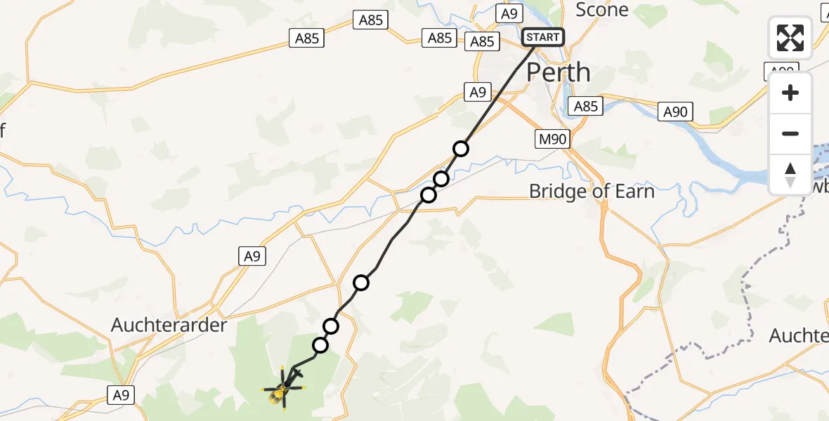
On Friday, 10 April 2026 at 13:37, a Police Helicopter departed from Perth to Upper Beldhill. It was the Police Helicopter with registration number G-BZRS. The flight lasted 6 minutes. During that period, the aircraft travelled 12 miles at an average speed of 122 miles per hour at a maximum altitude of 2525 feet.
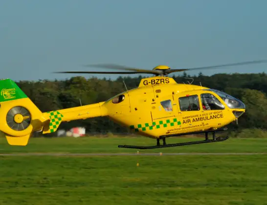
Helicopter: G-BZRS
The helicopter G-BZRS is used by the British police. The helicopter is deployed in pursuits, missing persons cases and other incidents where a helicopter provides added value.
Photo: NMOS332
12 miles
2525 feet
122 mph
6 minutes
13:37
13:43

Route
Upper Beldhill, Perth and Kinross13:43
Rossie Law Hill Fort, Perth and Kinross13:43
Kippen, Perth and Kinross13:42
Dunning, Perth and Kinross13:42
Forteviot, Perth and Kinross13:40
Perth, Perth and Kinross13:40
Forteviot, Perth and Kinross13:39
Gowans Terrace, Perth and Kinross13:37
Recently
Police Helicopter to Culter9 Jul 23:28
Coastguard Helicopter to Solent Airport9 Jul 23:22
Flights Perth
Police Helicopter to Perth and Kinross, B9341 Jul 16:10
Police Helicopter to Little Powgavie, B95824 Jun 10:08
Police Helicopter to Pitcairngreen15 Jun 18:24
Police Helicopter to Perth, Dower Place5 Jun 17:33
Police Helicopter to Perth, Kilda Road5 Jun 14:29
Police Helicopter to Perth, Maxton Place4 Jun 13:57
Police Helicopter to Perth31 May 13:25
Police Helicopter to Perth, M9011 May 18:31
Helicopter flights on your website?
You can easily display helicopter flights on your own website. Use the embed code.
