Air Ambulance Helicopter to Maldon, Blackwater Rail Trail
Friday, 10 April 2026 | 9:27 | From Earls Colne Airfield
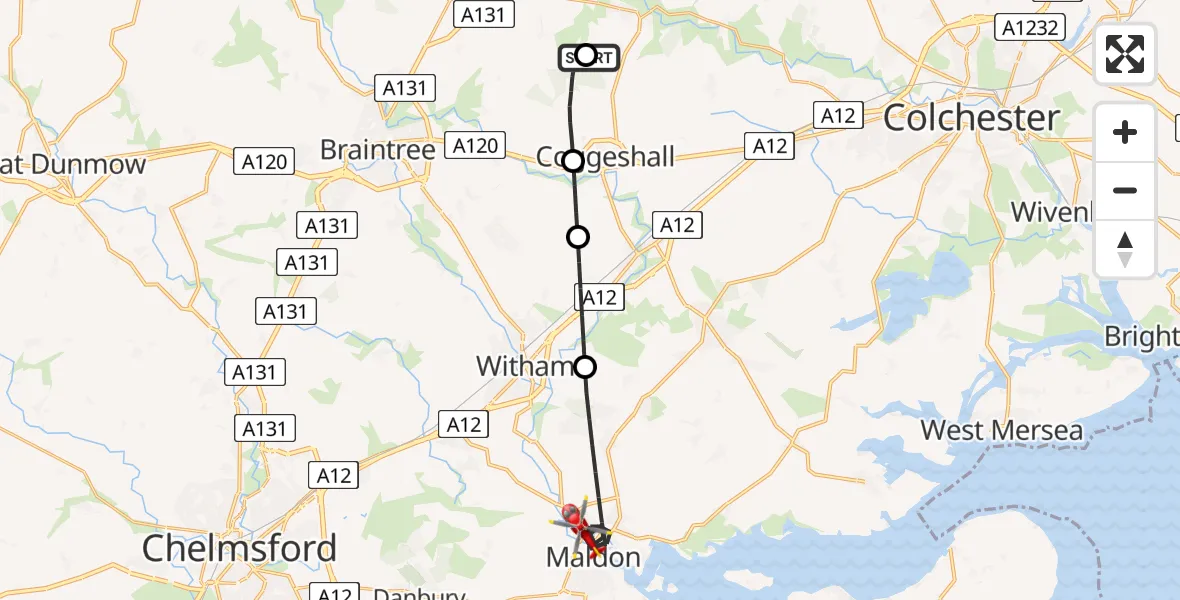
On Friday, 10 April 2026 at 9:27, a Air Ambulance Helicopter departed from Earls Colne Airfield to Maldon. It was the Air Ambulance Helicopter with registration number G-EHAT. The flight lasted 13 minutes. During that period, the aircraft travelled 17 miles at an average speed of 78 miles per hour at a maximum altitude of 875 feet.
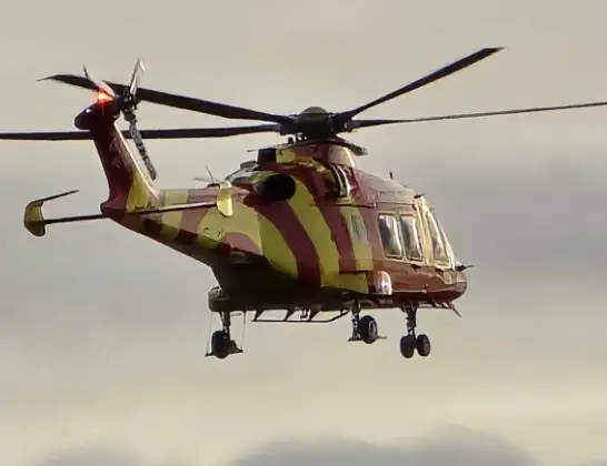
Helicopter: G-EHAT
The helicopter G-EHAT is used as a air ambulance helicopter. The main purpose of this aircraft is to transport a Mobile Medical Team to an incident as quickly as possible, enabling the trauma doctor to provide immediate first aid on site. The aircraft is flying this flight as Air Ambulance Helicopter.
Photo: By Steve Knight
17 miles
875 feet
78 mph
13 minutes
09:27
09:40

Route
Maldon, Essex09:40
Blackwater Rail Trail, Essex09:39
Maldon, Essex09:34
Braintree, Essex09:33
Coggeshall, Essex09:32
Keeper's Lane, Essex09:31
Braintree, Essex09:30
Earls Colne Airfield, Colchester, Essex09:27
Live flights
Today
Police Helicopter to Llandwrog19:32:38
Flights Maldon
Air Ambulance Helicopter to Papworth Hospital25 Jun 17:46
Air Ambulance Helicopter to Maldon, Maypole Road25 Jun 16:27
Coastguard Drone to Maldon, Batt's Road24 Jun 06:40
Air Ambulance Helicopter to Papworth Hospital13 Jun 18:01
Air Ambulance Helicopter to Maldon, Maldon Road13 Jun 16:22
Helicopter flights on your website?
You can easily display helicopter flights on your own website. Use the embed code.
