Police Helicopter to Bournemouth Airport
Thursday, 9 April 2026 | 17:24 | From Bournemouth Airport
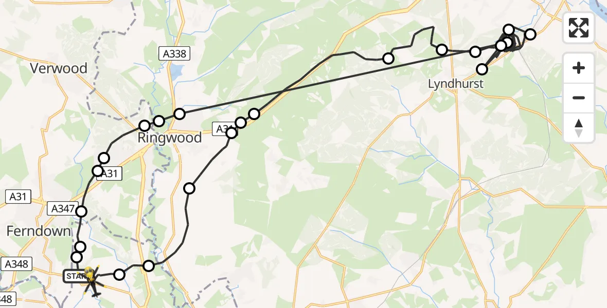
On Thursday, 9 April 2026 at 17:24, a Police Helicopter departed from Bournemouth Airport to Bournemouth Airport. It was the Police Helicopter with registration number G-CPAO. The flight lasted 41 minutes. During that period, the aircraft travelled 55 miles at an average speed of 80 miles per hour at a maximum altitude of 1475 feet.
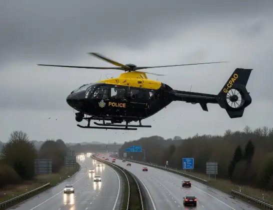
Helicopter: G-CPAO
The helicopter G-CPAO is used by the British police. The helicopter is deployed in pursuits, missing persons cases and other incidents where a helicopter provides added value.
Photo: Tony Melony
55 miles
1475 feet
80 mph
42 minutes
17:24
18:05

Route
Bournemouth Airport, Bournemouth18:05
Bournemouth Airport, Bournemouth18:04
Hurn, Bournemouth, Christchurch and Poole18:04
New Forest, Hampshire18:02
Hightown, Hampshire18:01
Poulner, Hampshire18:01
Burley, Hampshire18:00
New Forest, Hampshire17:57
Minstead, Hampshire17:55
New Forest, Hampshire17:55
Ashurst, Hampshire17:41
New Forest, Hampshire17:41
Ashurst, Hampshire17:35
Woodlands, Hampshire17:34
Ashurst, Hampshire17:34
Poulner, Hampshire17:28
Ringwood, Hampshire17:27
St Ives, Dorset17:27
Ashley Heath, Dorset17:26
St Leonards, Dorset17:26
Ferndown, Dorset17:25
Hurn, Bournemouth, Christchurch and Poole17:25
Parley Cross, Dorset17:24
Bournemouth Airport, Bournemouth17:24
Live flights
Today
Helicopter flights on your website?
You can easily display helicopter flights on your own website. Use the embed code.
