Air Ambulance Helicopter to Coventry Airport
Thursday, 9 April 2026 | 9:39 | From Northampton
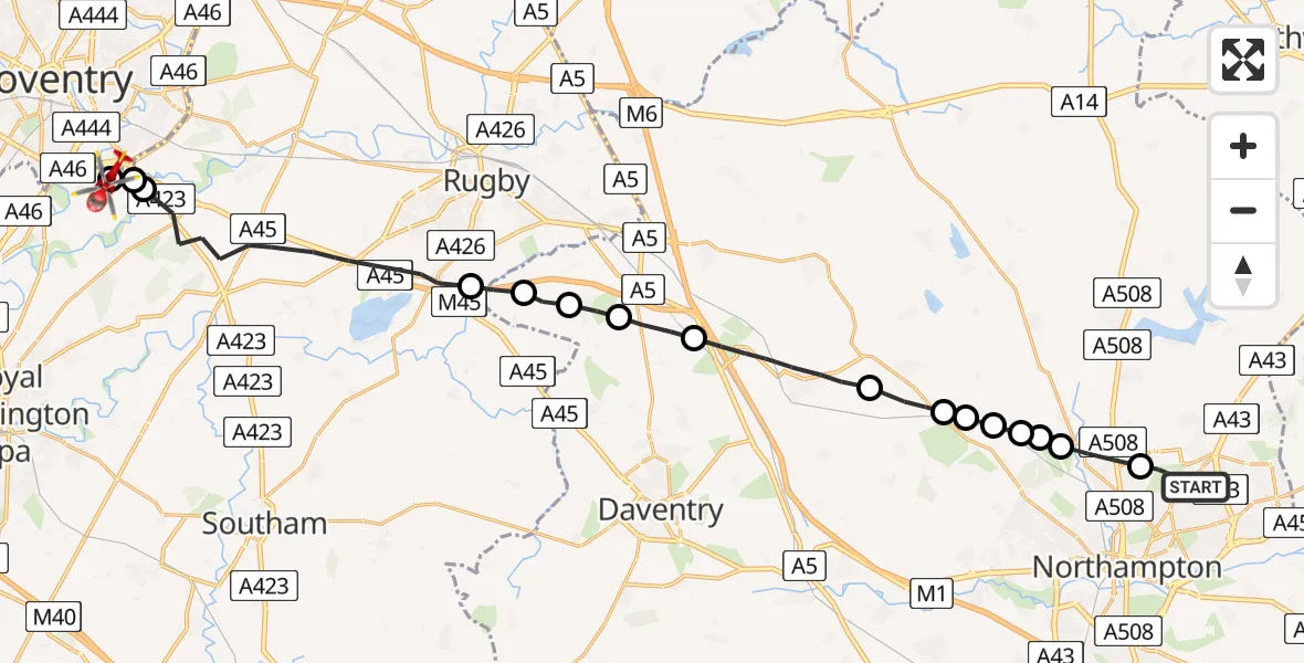
On Thursday, 9 April 2026 at 9:39, a Air Ambulance Helicopter departed from Northampton to Coventry Airport. It was the Air Ambulance Helicopter with registration number G-WNAS. The flight lasted 12 minutes. During that period, the aircraft travelled 28 miles at an average speed of 141 miles per hour at a maximum altitude of 1250 feet.
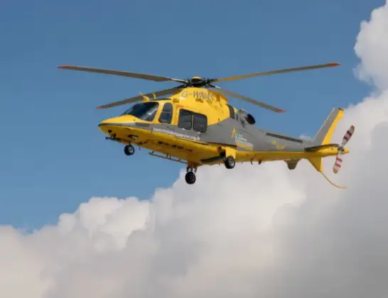
Helicopter: G-WNAS
The helicopter G-WNAS is used as an ambulance helicopter. The helicopter is equipped with a stretcher for transporting patients. The helicopter is often used to transport to hospitals.
Photo: Tony Melony
29 miles
1250 feet
141 mph
13 minutes
09:39
09:51

Route
Coventry Airport, Coventry, West Midlands09:51
Coventry Airport, Coventry, West Midlands09:51
Tollbar End, Warwickshire09:51
Warwick, Warwickshire09:50
Rugby, Warwickshire09:47
Onley, West Northamptonshire09:46
Barby, West Northamptonshire09:46
Kilsby, West Northamptonshire09:45
Ashby St Ledgers, West Northamptonshire09:45
Long Buckby, West Northamptonshire09:43
East Haddon, West Northamptonshire09:42
Althorp, West Northamptonshire09:42
Holdenby, West Northamptonshire09:42
Harlestone, West Northamptonshire09:41
Church Brampton, West Northamptonshire09:41
Chapel Brampton, West Northamptonshire09:41
Boughton, West Northamptonshire09:40
Churchill Avenue, West Northamptonshire09:39
Live flights
Today
Flights Northampton
Air Ambulance Helicopter to Coventry Airport7 Jul 19:58
Air Ambulance Helicopter to Sywell Aerodrome3 Jul 07:57
Helicopter flights on your website?
You can easily display helicopter flights on your own website. Use the embed code.
