Police Helicopter to Sewardstonebury, Bury Road
Thursday, 9 April 2026 | 8:02 | From Sewardstonebury
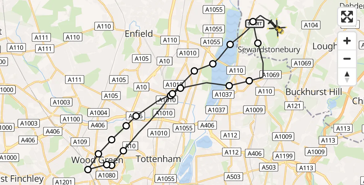
On Thursday, 9 April 2026 at 8:02, a Police Helicopter departed from Sewardstonebury to Sewardstonebury. It was the Police Helicopter with registration number G-MPSA. The flight lasted 8 minutes. During that period, the aircraft travelled 16 miles at an average speed of 116 miles per hour at a maximum altitude of 1250 feet.
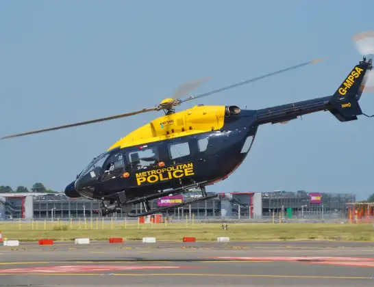
Helicopter: G-MPSA
The helicopter G-MPSA is used by the British police. The helicopter is deployed in pursuits, missing persons cases and other incidents where a helicopter provides added value.
Photo: Simon Boddy
16 miles
1250 feet
116 mph
9 minutes
08:02
08:11

Route
Bury Road, Essex08:11
Epping Forest, Essex08:10
Sewardstonebury, Essex08:09
Chingford, Waltham Forest08:08
Waltham Forest, Waltham Forest08:08
Ponders End, Enfield08:07
Enfield, Enfield08:07
Edmonton, Enfield08:07
Bowes, Enfield08:07
Haringey, Haringey08:06
St. Cuthbert's Church, Haringey08:06
Hornsey, Haringey08:06
Harringay, Haringey08:06
West Green, Haringey08:05
Haringey, Haringey08:05
Edmonton, Enfield08:04
Ponders End, Enfield08:04
William Girling Reservoir08:03
King George V Reservoir08:03
Daws Hill, Essex08:02
Live flights
Today
Flights Sewardstonebury
Police Helicopter to Sewardstonebury, Bury Road10 Jun 21:58
Police Helicopter to Sewardstonebury, Blind Lane10 Jun 18:19
Police Helicopter to Sewardstonebury, Green Ride10 Jun 16:35
Police Helicopter to Kingsbury, Cool Oak Lane10 Jun 15:59
Helicopter flights on your website?
You can easily display helicopter flights on your own website. Use the embed code.
