Air Ambulance Helicopter to Sellindge, Barrow Hill
Wednesday, 8 April 2026 | 18:12 | From Redhill Aerodrome
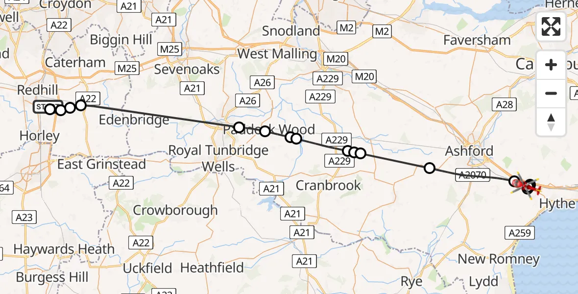
On Wednesday, 8 April 2026 at 18:12, a Air Ambulance Helicopter departed from Redhill Aerodrome to Sellindge. It was the Air Ambulance Helicopter with registration number G-KSSC. The flight lasted 23 minutes. During that period, the aircraft travelled 53 miles at an average speed of 139 miles per hour at a maximum altitude of 1175 feet.
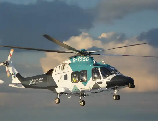
Helicopter: G-KSSC
The helicopter G-KSSC is used as a air ambulance helicopter. The main purpose of this aircraft is to transport a Mobile Medical Team to an incident as quickly as possible, enabling the trauma doctor to provide immediate first aid on site. The aircraft is flying this flight as Air Ambulance Helicopter.
Photo: Shona aakss
54 miles
1175 feet
139 mph
24 minutes
18:12
18:35

Route
Barrow Hill, Kent18:35
Sellindge, Kent18:35
Lympne, Kent18:35
Stanford, Kent18:35
Sellindge, Kent18:34
Lympne, Kent18:33
Sellindge, Kent18:33
Ashford, Kent18:29
Frittenden, Kent18:26
Headcorn, Kent18:26
Frittenden, Kent18:26
Maidstone, Kent18:24
Tunbridge Wells, Kent18:24
Paddock Wood, Kent18:23
Capel, Kent18:22
South Godstone, Surrey18:15
Tandridge, Surrey18:15
South Nutfield, Surrey18:14
Tandridge, Surrey18:14
Redhill Aerodrome, Redhill, Surrey18:13
Redhill Aerodrome, Redhill, Surrey18:12
Live flights
Police Helicopter on its way from Glasgow8 Apr 23:13
Police Helicopter on its way from Burnley8 Apr 22:37
Today
Police Helicopter to Glasgow, M88 Apr 23:09
Police Helicopter to Stepps, Flynn Gardens8 Apr 23:05
Coastguard Helicopter to Manston Airport8 Apr 22:51
Police Helicopter to Bournemouth Airport8 Apr 22:11
Air Ambulance Helicopter to St Andrews, A918 Apr 22:01
Police Helicopter to Burnley, Rosehill Road8 Apr 21:57
Police Helicopter to Glasgow City Heliport8 Apr 21:45
Flights Sellindge
Helicopter flights on your website?
You can easily display helicopter flights on your own website. Use the embed code.
