Air Ambulance Helicopter to North Weald Airfield
Wednesday, 8 April 2026 | 17:17 | From Earls Colne Airfield
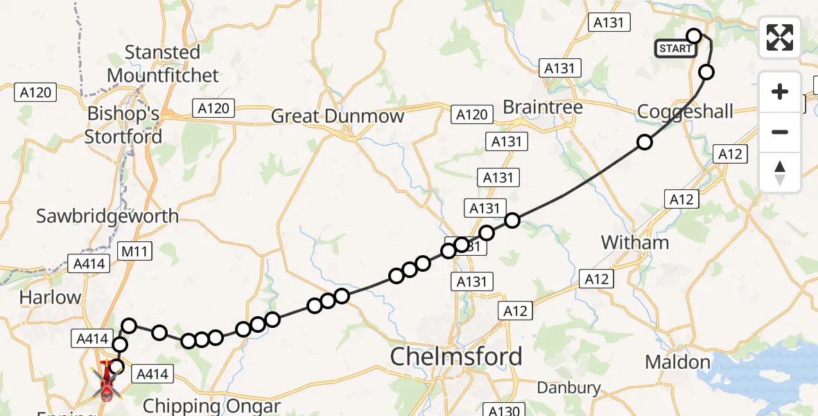
On Wednesday, 8 April 2026 at 17:17, a Air Ambulance Helicopter departed from Earls Colne Airfield to North Weald Airfield. It was the Air Ambulance Helicopter with registration number G-HHEM. The flight lasted 17 minutes. During that period, the aircraft travelled 32 miles at an average speed of 110 miles per hour at a maximum altitude of 1000 feet.
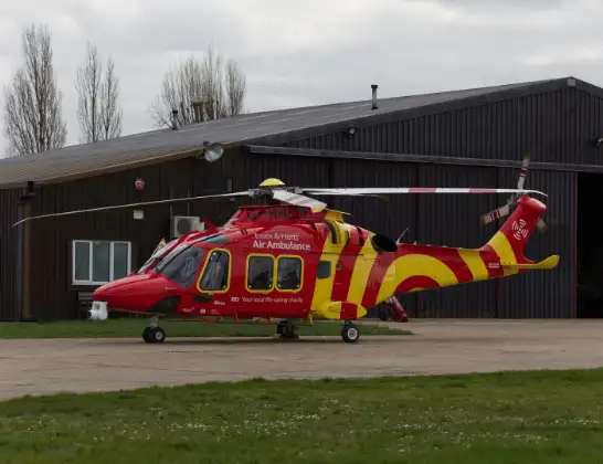
Helicopter: G-HHEM
The helicopter G-HHEM is used as a air ambulance helicopter. The main purpose of this aircraft is to transport a Mobile Medical Team to an incident as quickly as possible, enabling the trauma doctor to provide immediate first aid on site. The aircraft is flying this flight as Air Ambulance Helicopter.
Photo: Ronnie Macdonald
32 miles
1000 feet
110 mph
18 minutes
17:17
17:35

Route
North Weald Airfield, Epping, Essex17:35
North Weald Airfield, Epping, Essex17:33
North Weald Bassett, Essex17:32
Threshers Bush, Essex17:32
Magdalen Laver, Essex17:31
Moreton, Essex17:30
Little Laver, Essex17:30
Epping Forest, Essex17:29
Fyfield, Essex17:29
Epping Forest, Essex17:29
Fyfield, Essex17:28
Epping Forest, Essex17:28
Chelmsford, Essex17:27
Roxwell, Essex17:27
Chelmsford, Essex17:26
Great Waltham, Essex17:26
Pleshey, Essex17:26
Great Waltham, Essex17:25
Howe Street, Essex17:25
Chelmsford, Essex17:24
Great Leighs, Essex17:24
Braintree, Essex17:21
Coggeshall, Essex17:19
Braintree, Essex17:18
Earls Colne Airfield, Colchester, Essex17:17
Live flights
Today
Helicopter flights on your website?
You can easily display helicopter flights on your own website. Use the embed code.
