Police Helicopter to Newcastle International Airport
Wednesday, 8 April 2026 | 16:23 | From Newcastle International Airport
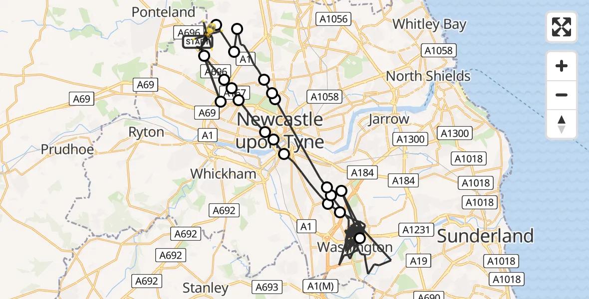
On Wednesday, 8 April 2026 at 16:23, a Police Helicopter departed from Newcastle International Airport to Newcastle International Airport. It was the Police Helicopter with registration number G-POLA. The flight lasted 43 minutes. During that period, the aircraft travelled 69 miles at an average speed of 97 miles per hour at a maximum altitude of 1325 feet.
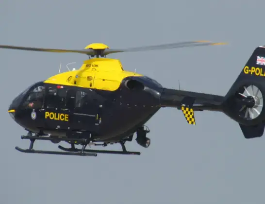
Helicopter: G-POLA
The helicopter G-POLA is used by the British police. The helicopter is deployed in pursuits, missing persons cases and other incidents where a helicopter provides added value.
Photo: ozz13x
70 miles
1325 feet
97 mph
44 minutes
16:23
17:06

Route
Newcastle International Airport, Newcastle upon Tyne, Tyne and Wear17:06
Newcastle International Airport, Newcastle upon Tyne, Tyne and Wear17:05
Newcastle upon Tyne, Newcastle upon Tyne17:04
Hazlerigg Village, Newcastle upon Tyne17:04
Coxlodge, Newcastle upon Tyne17:03
Gosforth, Newcastle upon Tyne17:02
Haymarket, Newcastle upon Tyne17:02
Gateshead, Gateshead17:00
Washington, Gateshead17:00
Washington, Sunderland16:58
Gateshead, Gateshead16:57
Washington, Sunderland16:27
Washington, Gateshead16:27
Gateshead, Gateshead16:26
Grainger Town, Newcastle upon Tyne16:26
Arthur's Hill, Newcastle upon Tyne16:25
Cowgate, Newcastle upon Tyne16:25
Blakelaw, Newcastle upon Tyne16:24
Kenton, Newcastle upon Tyne16:24
Woolsington, Newcastle upon Tyne16:23
Blakelaw, Newcastle upon Tyne16:23
Airport Freightway, Tyne and Wear - Newcastle upon Tyne16:23
Live flights
Today
Helicopter flights on your website?
You can easily display helicopter flights on your own website. Use the embed code.
