Air Ambulance Helicopter to Stirling
Wednesday, 8 April 2026 | 13:01 | From Glasgow Airport
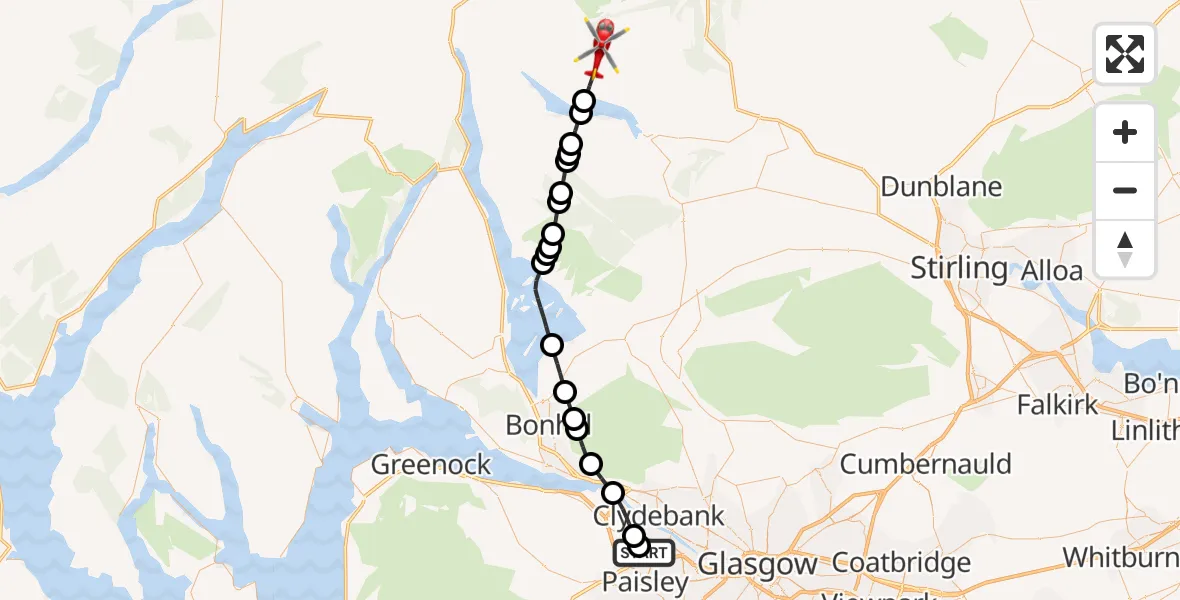
On Wednesday, 8 April 2026 at 13:01, a Air Ambulance Helicopter departed from Glasgow Airport to Stirling. It was the Air Ambulance Helicopter with registration number G-GSAS. The flight lasted 15 minutes. During that period, the aircraft travelled 32 miles at an average speed of 132 miles per hour at a maximum altitude of 2400 feet.
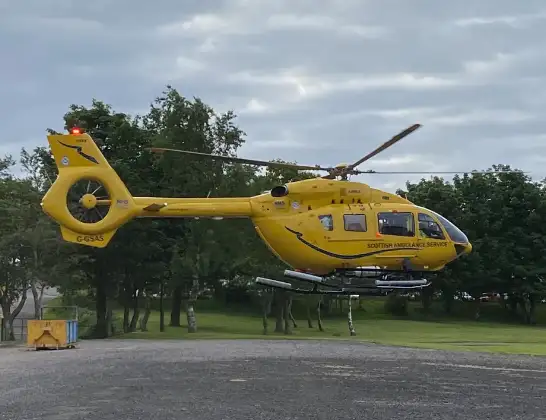
Helicopter: G-GSAS
The helicopter G-GSAS is used as a air ambulance helicopter. The main purpose of this aircraft is to transport a Mobile Medical Team to an incident as quickly as possible, enabling the trauma doctor to provide immediate first aid on site. The aircraft is flying this flight as Air Ambulance Helicopter.
Photo: Scanbus
33 miles
2400 feet
132 mph
15 minutes
13:01
13:15

Route
Stirling, Stirling13:15
Stirling, Stirling13:14
Loch Katrine13:14
Stirling, Stirling13:13
Kinlochard, Stirling13:13
Loch Chon13:13
Stronmacnair (ruin), Stirling13:12
Stirling, Stirling13:12
Gleann Meadhonach, Stirling13:11
Stirling, Stirling13:11
Cashell, Stirling13:10
Sallochy, Stirling13:10
Loch Lomond13:08
Balloch, West Dunbartonshire13:07
Bonhill, West Dunbartonshire13:06
Dumbarton, West Dunbartonshire13:06
Milton, West Dunbartonshire13:05
Bowling, West Dunbartonshire13:04
Erskine, Renfrewshire13:02
Inchinnan, Renfrewshire13:02
Glasgow Airport, Glasgow13:01
Glasgow Airport, Glasgow13:01
Live flights
Police Helicopter on its way from MOD St Athan15 Jul 23:53
Police Helicopter on its way from Wrenthorpe15 Jul 23:36
Today
Police Helicopter to Glasgow, Renfrew Road15 Jul 23:45
Police Helicopter to Manchester Barton Aerodrome15 Jul 23:33
Police Helicopter to Renfrewshire15 Jul 23:32
Air Ambulance Helicopter to Southampton Airport15 Jul 23:30
Police Helicopter to Coopersale, Epping Road15 Jul 23:07
Police Helicopter to Largs, Lane 115 Jul 23:02
Flights Stirling
Police Helicopter to Linwood, B81814 Jul 13:04
Air Ambulance Helicopter to Inner Seas12 Jul 20:45
Police Helicopter to Stirling, New Line Road12 Jul 14:32
Coastguard Helicopter to Killin, Stirling22 Jun 14:48
Coastguard Helicopter to Killin, Stirling22 Jun 14:24
Coastguard Helicopter to Stirling, A8421 Jun 16:32
Helicopter flights on your website?
You can easily display helicopter flights on your own website. Use the embed code.
