Police Helicopter to Pity Me, Cartington Road
Tuesday, 7 April 2026 | 7:24 | From Newcastle International Airport
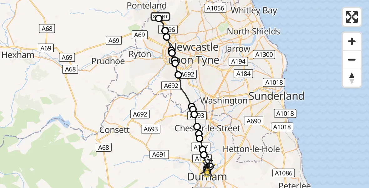
On Tuesday, 7 April 2026 at 7:24, a Police Helicopter departed from Newcastle International Airport to Pity Me. It was the Police Helicopter with registration number G-POLA. The flight lasted 13 minutes. During that period, the aircraft travelled 21 miles at an average speed of 95 miles per hour at a maximum altitude of 1750 feet.
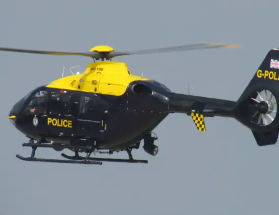
Helicopter: G-POLA
The helicopter G-POLA is used by the British police. The helicopter is deployed in pursuits, missing persons cases and other incidents where a helicopter provides added value.
Photo: ozz13x
21 miles
1750 feet
95 mph
14 minutes
07:24
07:37

Route
Cartington Road, County Durham07:37
Pity Me, County Durham07:36
Durham, County Durham07:35
Pity Me, County Durham07:34
Durham, County Durham07:34
Pity Me, County Durham07:33
Chester-le-Street, County Durham07:33
Chester Moor, County Durham07:32
Pelton Fell, County Durham07:32
Chester-le-Street, County Durham07:31
Perkinsville, County Durham07:31
High Handenhold, County Durham07:30
Gateshead, County Durham07:30
Gateshead, Gateshead07:28
Whickham, Gateshead07:27
Gateshead, Gateshead07:27
Benwell, Newcastle upon Tyne07:26
Cowgate, Newcastle upon Tyne07:26
Blakelaw, Newcastle upon Tyne07:25
Woolsington, Newcastle upon Tyne07:25
Callerton, Newcastle upon Tyne07:24
Newcastle International Airport, Newcastle upon Tyne, Tyne and Wear07:24
Today
Helicopter flights on your website?
You can easily display helicopter flights on your own website. Use the embed code.
