Air Ambulance Helicopter to RAF Cosford
Monday, 6 April 2026 | 21:17 | From Queen Elizabeth Hospital Helipad
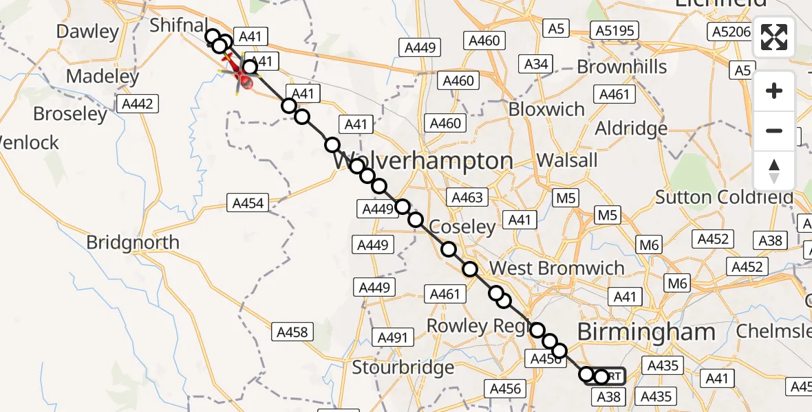
On Monday, 6 April 2026 at 21:17, a Air Ambulance Helicopter departed from Queen Elizabeth Hospital Helipad to RAF Cosford. It was the Air Ambulance Helicopter with registration number G-SCAA. The flight lasted 10 minutes. During that period, the aircraft travelled 25 miles at an average speed of 145 miles per hour at a maximum altitude of 1850 feet.
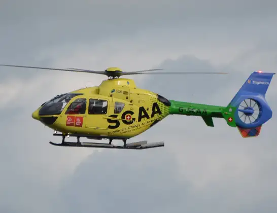
Helicopter: G-SCAA
The helicopter G-SCAA is used as a air ambulance helicopter. The main purpose of this aircraft is to transport a Mobile Medical Team to an incident as quickly as possible, enabling the trauma doctor to provide immediate first aid on site. The aircraft is flying this flight as Air Ambulance Helicopter.
Photo: Jonathan Payne
26 miles
1850 feet
145 mph
11 minutes
21:17
21:28

Route
RAF Cosford, Cosford21:28
Tong, Shropshire21:27
Shifnal, Shropshire21:26
Tong, Shropshire21:26
RAF Cosford, Cosford21:26
Albrighton, Shropshire21:25
South Staffordshire, Shropshire21:24
South Staffordshire, Staffordshire21:24
Tettenhall Wood, Wolverhampton21:23
Castlecroft, Staffordshire21:23
Merryhill, Wolverhampton21:23
Goldthorn Hill, Wolverhampton21:22
Dudley, Staffordshire21:22
Coseley, Dudley21:21
Dudley, Dudley21:21
Oakham, Sandwell21:20
Tividale, Sandwell21:20
Causeway Green, Sandwell21:19
Brandhall, Sandwell21:19
Warley Salop, Sandwell21:19
Birmingham, Birmingham21:18
Metchley, Birmingham21:17
West Gate, West Midlands - Birmingham21:17
Live flights
Today
Helicopter flights on your website?
You can easily display helicopter flights on your own website. Use the embed code.
