Air Ambulance Helicopter to West Lulworth, Britwell Drive
Monday, 6 April 2026 | 14:13 | From Henstridge Airfield
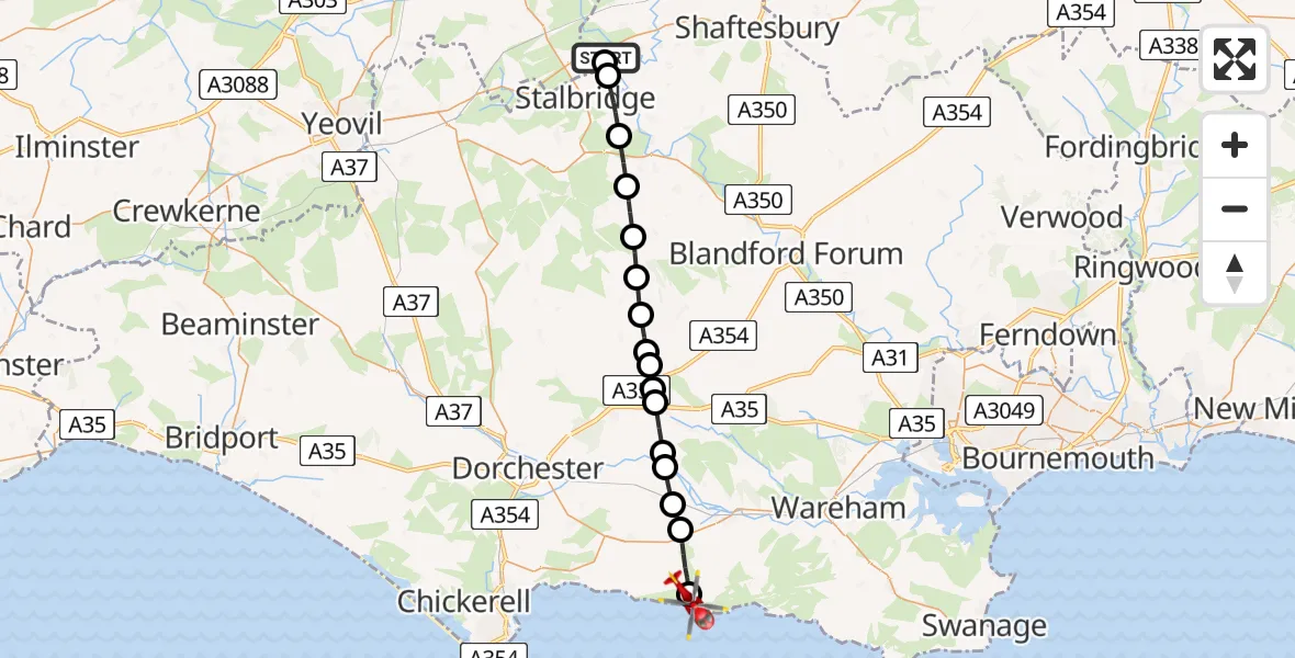
On Monday, 6 April 2026 at 14:13, a Air Ambulance Helicopter departed from Henstridge Airfield to West Lulworth. It was the Air Ambulance Helicopter with registration number G-DSAA. The flight lasted 15 minutes. During that period, the aircraft travelled 26 miles at an average speed of 104 miles per hour at a maximum altitude of 1200 feet.
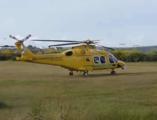
Helicopter: G-DSAA
The helicopter G-DSAA is used as a air ambulance helicopter. The main purpose of this aircraft is to transport a Mobile Medical Team to an incident as quickly as possible, enabling the trauma doctor to provide immediate first aid on site. The aircraft is flying this flight as Air Ambulance Helicopter.
Photo: Andrew Bone
27 miles
1200 feet
104 mph
16 minutes
14:13
14:29

Route
Britwell Drive, Dorset14:29
West Lulworth, Dorset14:27
Winfrith Newburgh, Dorset14:26
East Knighton, Dorset14:25
Moreton, Dorset14:25
Tincleton, Dorset14:24
Tolpuddle, Dorset14:23
Dewlish, Dorset14:23
Milborne St Andrew, Dorset14:23
Dorchester, Dorset14:22
Cheselbourne, Dorset14:22
Higher Ansty, Dorset14:21
Woolland, Dorset14:20
Fifehead St Quintin, Dorset14:19
Sturminster Newton, Dorset14:18
Stalbridge, Dorset14:16
Henstridge, Somerset14:16
Henstridge Airfield, Templecombe, Somerset14:13
Live flights
Today
Coastguard Helicopter to Solent Airport5 Jul 23:21
Air Ambulance Aircraft to RAF Lossiemouth5 Jul 23:17
Police Helicopter to Glasgow, Beech Avenue5 Jul 23:05
Police Aircraft to East Midlands Airport5 Jul 22:38
Air Ambulance Helicopter to North Sea5 Jul 22:14
Police Helicopter to Solihull, Centro Way5 Jul 22:09
Police Helicopter to Hawarden Airport5 Jul 21:47
Helicopter flights on your website?
You can easily display helicopter flights on your own website. Use the embed code.
